
Go Roman
1K+
Downloads

Everyone
info


About this game
In this newly redeveloped app, learn what life was like at Bar Hill fort, one of several Roman forts and fortlets built along the Antonine Wall in Scotland nearly 2,000 years ago.
This educational app has a number of features for you to enjoy:
FEATURE: PLAY GAME
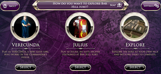
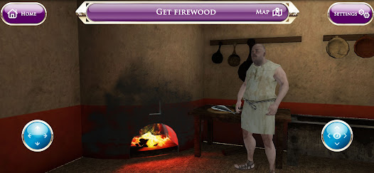
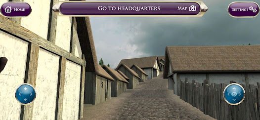
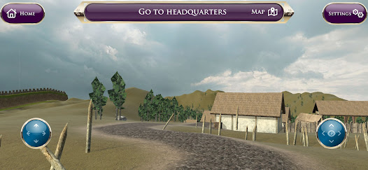
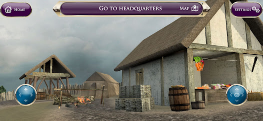
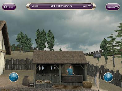
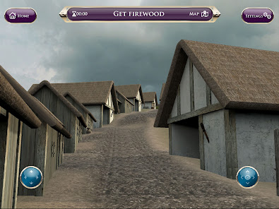
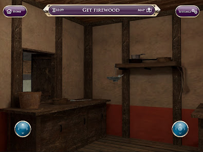
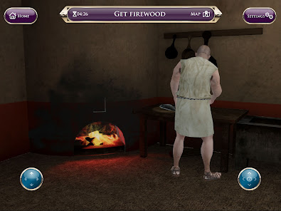
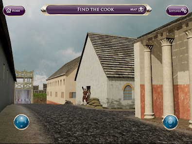
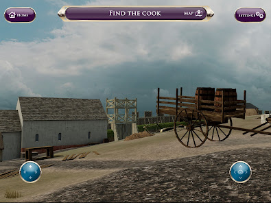
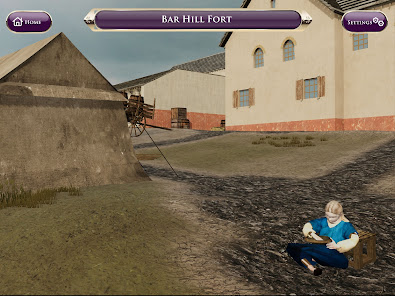
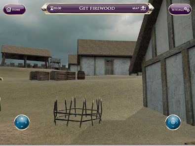
Play this interactive game as either Julius, an elite Roman archer or Verecunda, a new slave girl to find out what life was like at the fort and help them complete their tasks on time. As you play, collect hidden coins to discover the stories of those who lived in or near the fort.
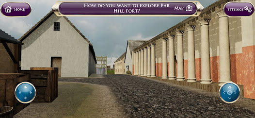
FEATURE: EXPLORE BAR HILL FORT IN 3D
Through state-of-the art interactive 3D models, explore this digital reconstruction of Bar Hill Fort at your own pace.
FEATURE: EXAMINE 3D MODELS OF ROMAN ARTEFACTS
Examine 3D models of archaeological artefacts excavated at Bar Hill fort or along the Antonine Wall and learn what these items are, where they were likely made, and how they would have been used.
ABOUT THE ANTONINE WALL
The Antonine Wall was the most northernly frontier of the Roman Empire nearly 2,000 years ago. It ran for 40 Roman miles (60km) from modern Bo’ness, on the Firth of Forth, to Old Kilpatrick on the River Clyde. The wall is part of the UNESCO designated, transnational Frontiers of the Roman Empire World Heritage Site.
Did you know that the Antonine Wall was never built as a stone wall? It was, in fact, a turf rampart with a wide and deep ditch in front. Forts and fortlets were constructed along the wall and housed the troops stationed at the frontier. Learn more at: https://antoninewall.org/
ABOUT DIGITAL DOCUMENTATION
The 3D model of Bar Hill fort was made using aerial LiDAR (Light Detection and Ranging), an aerial mapping technology that captures accurate 3D representations of a landscape. This provided the ground plan.
Terrestrial laser scanning recorded the archaeology at Bar Hill. A laser scanner is typically a tripod mounted device which sends out a beam of laser energy, scanning object surfaces up to 1 million times every second. The data captured is called a point cloud which accurately represents the surface geometry of the object and produces a 3D snapshot in time.
The 3D models of Roman artefacts were created by a digital documentation technique called photogrammetry (or structure from motion). Hundreds or thousands of overlapping digital photographs of the artefact are processed to create a 3D model with realistic photo textures.
FEEDBACK WELCOME
We are always looking to improve our digital services and we welcome feedback on our apps. If you have any ideas or suggestions on how we can improve this app, please email: digital@hes.scot
Want to show how much you love Go Roman? Please rate us in the app store.
ABOUT THIS APP
This app was first created by Historic Environment Scotland and The Glasgow School of Art, and was redeveloped by Grizzle and Tan in 2022. Historic Environment Scotland © 2023
This educational app has a number of features for you to enjoy:
FEATURE: PLAY GAME
Play this interactive game as either Julius, an elite Roman archer or Verecunda, a new slave girl to find out what life was like at the fort and help them complete their tasks on time. As you play, collect hidden coins to discover the stories of those who lived in or near the fort.
FEATURE: EXPLORE BAR HILL FORT IN 3D
Through state-of-the art interactive 3D models, explore this digital reconstruction of Bar Hill Fort at your own pace.
FEATURE: EXAMINE 3D MODELS OF ROMAN ARTEFACTS
Examine 3D models of archaeological artefacts excavated at Bar Hill fort or along the Antonine Wall and learn what these items are, where they were likely made, and how they would have been used.
ABOUT THE ANTONINE WALL
The Antonine Wall was the most northernly frontier of the Roman Empire nearly 2,000 years ago. It ran for 40 Roman miles (60km) from modern Bo’ness, on the Firth of Forth, to Old Kilpatrick on the River Clyde. The wall is part of the UNESCO designated, transnational Frontiers of the Roman Empire World Heritage Site.
Did you know that the Antonine Wall was never built as a stone wall? It was, in fact, a turf rampart with a wide and deep ditch in front. Forts and fortlets were constructed along the wall and housed the troops stationed at the frontier. Learn more at: https://antoninewall.org/
ABOUT DIGITAL DOCUMENTATION
The 3D model of Bar Hill fort was made using aerial LiDAR (Light Detection and Ranging), an aerial mapping technology that captures accurate 3D representations of a landscape. This provided the ground plan.
Terrestrial laser scanning recorded the archaeology at Bar Hill. A laser scanner is typically a tripod mounted device which sends out a beam of laser energy, scanning object surfaces up to 1 million times every second. The data captured is called a point cloud which accurately represents the surface geometry of the object and produces a 3D snapshot in time.
The 3D models of Roman artefacts were created by a digital documentation technique called photogrammetry (or structure from motion). Hundreds or thousands of overlapping digital photographs of the artefact are processed to create a 3D model with realistic photo textures.
FEEDBACK WELCOME
We are always looking to improve our digital services and we welcome feedback on our apps. If you have any ideas or suggestions on how we can improve this app, please email: digital@hes.scot
Want to show how much you love Go Roman? Please rate us in the app store.
ABOUT THIS APP
This app was first created by Historic Environment Scotland and The Glasgow School of Art, and was redeveloped by Grizzle and Tan in 2022. Historic Environment Scotland © 2023
Updated on
Safety starts with understanding how developers collect and share your data. Data privacy and security practices may vary based on your use, region, and age. The developer provided this information and may update it over time.

No data shared with third parties
Learn more about how developers declare sharing

No data collected
Learn more about how developers declare collection
What's new
Updates to improve app stability


