
Sgafot Sis. Gestión Ayudas PAC
50K+
Downloads

Everyone
info
About this app
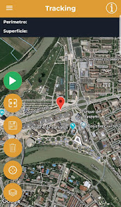
The Spanish Agricultural Guarantee Fund and 13 Autonomous Communities make the SgaFot application available for taking georeferenced photographs associated with files within the framework of Single Applications processed through the Aid Management System (SGA).
In the current version it will be possible to work with the Autonomous Communities of: Andalusia, Aragon, Asturias, Balearic Islands, Cantabria, Castilla La Mancha, Extremadura, Galicia, Madrid, Murcia, Navarra, La Rioja and C. Valenciana.
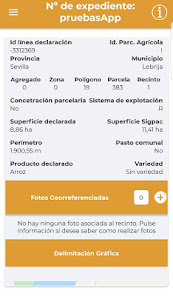
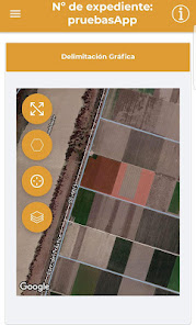
Through this application, it will be possible to consult the identification and delimitation data of the lines of declaration of Precincts of the files and applications and take photographs and tracking associated with these lines.
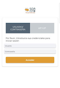
Access to the files is done through the authentication and authorization systems that the SGA system has, so that the user can only consult the files to which they have permission within their scope. If you do not have a user in the system, you must go to your C.A. or request it through the Citizen Portal of the SGA system.
This application can be executed individually or be invoked from the Sga@pp app for Consultation of file data, which is also provided by the SGA system.
Do you have comments? Send your comments to the C.A. that manages your file or if they were general about the app, to the email: sga.soporte@tragsa.es
In the current version it will be possible to work with the Autonomous Communities of: Andalusia, Aragon, Asturias, Balearic Islands, Cantabria, Castilla La Mancha, Extremadura, Galicia, Madrid, Murcia, Navarra, La Rioja and C. Valenciana.
Through this application, it will be possible to consult the identification and delimitation data of the lines of declaration of Precincts of the files and applications and take photographs and tracking associated with these lines.
Access to the files is done through the authentication and authorization systems that the SGA system has, so that the user can only consult the files to which they have permission within their scope. If you do not have a user in the system, you must go to your C.A. or request it through the Citizen Portal of the SGA system.
This application can be executed individually or be invoked from the Sga@pp app for Consultation of file data, which is also provided by the SGA system.
Do you have comments? Send your comments to the C.A. that manages your file or if they were general about the app, to the email: sga.soporte@tragsa.es
Updated on
Safety starts with understanding how developers collect and share your data. Data privacy and security practices may vary based on your use, region, and age. The developer provided this information and may update it over time.

This app may share these data types with third parties
Location

No data collected
Learn more about how developers declare collection

Data isn’t encrypted
Data can’t be deleted