
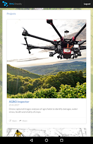
AGRO Inspector
1K+
Downloads

Everyone
info
About this app
AGRO Inspector analyzes multispectral and RGB data from drones and aircraft captured images. It gives you access to your data anytime, anywhere from your device. Recommended for drone owners, farmers and insurance companies for recognising potential damage to crops (like wheat, corn, oil seed rape).
The mobile application comes from a desktop solution that is available for you and your clients, too. For more information about technical specification and workflow, please send request to info@tmgdronity.com.
Features:
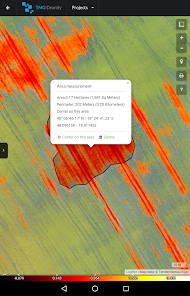
- Fast area and distance measuring
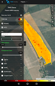
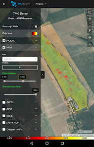
- 1 cm/pixel ORTHOMOSAIC, DSM, DTM
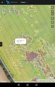
- index maps : NDVI, NDRE, GNDVI, GRVI
- Filtering different indices value in layers
- Set transparency layers
- Onscreen review of existing data
- Multiple coordinate formats
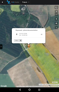
- Smart Marker Mode for super accurate pin placement
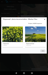
- Markers can contain different types of files (archives, images, documents)
- Base map : Satellite, Terrain, Roadmap and Hybrid modes
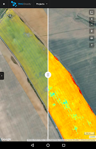
- Comparing layers and monitoring of changes in time
- ability to share your maps
Technical Features:
- No ads
- Minimum permission
Discover our web and services, including rates: https://agro-inspector.com/
The mobile application comes from a desktop solution that is available for you and your clients, too. For more information about technical specification and workflow, please send request to info@tmgdronity.com.
Features:
- Fast area and distance measuring
- 1 cm/pixel ORTHOMOSAIC, DSM, DTM
- index maps : NDVI, NDRE, GNDVI, GRVI
- Filtering different indices value in layers
- Set transparency layers
- Onscreen review of existing data
- Multiple coordinate formats
- Smart Marker Mode for super accurate pin placement
- Markers can contain different types of files (archives, images, documents)
- Base map : Satellite, Terrain, Roadmap and Hybrid modes
- Comparing layers and monitoring of changes in time
- ability to share your maps
Technical Features:
- No ads
- Minimum permission
Discover our web and services, including rates: https://agro-inspector.com/
Updated on
Safety starts with understanding how developers collect and share your data. Data privacy and security practices may vary based on your use, region, and age. The developer provided this information and may update it over time.

No data shared with third parties
Learn more about how developers declare sharing

No data collected
Learn more about how developers declare collection


