
Zaragoza Parking
4.1star
81 reviews
10K+
Downloads

Everyone
info


About this app
Zaragoza City Council official application that allows access to useful information related to parking in the city.
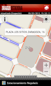
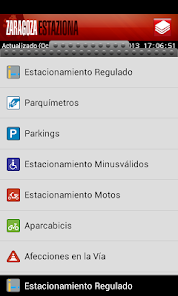
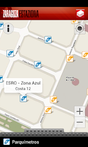
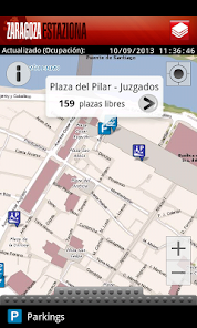
It displays on a map on real time information about occupancy of regulated parking areas using a simple colours code. In addition, it shows identification of each section of regulated parking areas named as ESRE (mixed resident-rotary) or ESRO (rotary) and parking meters location. Other useful information is also included: public parking with detailed information about accesses, parking for the handicapped, parking for bicycles and motorcycles. Furthermore, the application informs on real time about incidents on the street with effects on traffic.
This application provides a dynamic and active vision of Zaragoza with the objective of improving urban mobility and facilitating day-to-day citizen’s life.
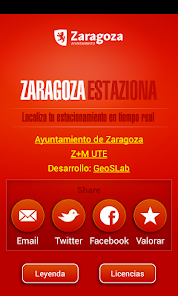
Information provided by Zaragoza City Council (http://www.zaragoza.es) and Z+M UTE (http://www.zmute.com), Service of regulated parking in Zaragoza. Developed by GeoSLab (http://www.geoslab.com).
If you want to make any suggestion or contribution, please use the Service of Complaints and Suggestions (https://www.zaragoza.es/ciudad/ticketing/verNuevaQuejaAnonima_Ticketing) offered by Zaragoza City Council.
It displays on a map on real time information about occupancy of regulated parking areas using a simple colours code. In addition, it shows identification of each section of regulated parking areas named as ESRE (mixed resident-rotary) or ESRO (rotary) and parking meters location. Other useful information is also included: public parking with detailed information about accesses, parking for the handicapped, parking for bicycles and motorcycles. Furthermore, the application informs on real time about incidents on the street with effects on traffic.
This application provides a dynamic and active vision of Zaragoza with the objective of improving urban mobility and facilitating day-to-day citizen’s life.
Information provided by Zaragoza City Council (http://www.zaragoza.es) and Z+M UTE (http://www.zmute.com), Service of regulated parking in Zaragoza. Developed by GeoSLab (http://www.geoslab.com).
If you want to make any suggestion or contribution, please use the Service of Complaints and Suggestions (https://www.zaragoza.es/ciudad/ticketing/verNuevaQuejaAnonima_Ticketing) offered by Zaragoza City Council.
Updated on
Safety starts with understanding how developers collect and share your data. Data privacy and security practices may vary based on your use, region, and age. The developer provided this information and may update it over time.

No data shared with third parties
Learn more about how developers declare sharing

No data collected
Learn more about how developers declare collection
Ratings and reviews
4.1
81 reviews

A Google user
- Flag inappropriate
March 13, 2014
What's new
Enable support for the latest Android versions


