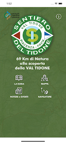
Sentiero del Tidone
1K+
Downloads

Everyone
info
About this app
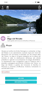
The Sentiero del Tidone is a 69 km long path to be covered on foot, by bike or on horseback and which runs along the entire branch of the Tidone stream crossing two regions (Emilia-Romagna and Lombardy), two provinces (Piacenza and Pavia) and several municipalities (Rottofreno, Sarmato, Borgonovo Val Tidone, Pianello Val Tidone, Alta Val Tidone, Zavattarello, Romagnese).
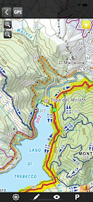
It starts from Boscone Cusani (in the locality of Gerra Vecchia) in the municipality of Rottofreno and flanks the Po to the point where the Tidone flows into the river and then goes up the stream to the Molato dam where, along the lake of Trebecco, it reaches the province di Pavia and ends at the source in Case Matti.
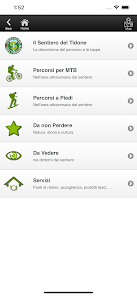
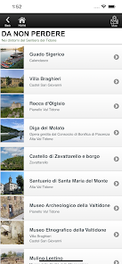
The most important features
- know where you are with the GPS point
- recording of your own track that can be shared with friends
- registration of georeferenced annotations
- remember the place where the car was parked
- receive a warning when you stray too far from the path
The App allows you to record tracks even when the screen is off, so in this mode, and only in this recording mode, prolonged use of GPS in the background can drastically reduce battery life.
It starts from Boscone Cusani (in the locality of Gerra Vecchia) in the municipality of Rottofreno and flanks the Po to the point where the Tidone flows into the river and then goes up the stream to the Molato dam where, along the lake of Trebecco, it reaches the province di Pavia and ends at the source in Case Matti.
The most important features
- know where you are with the GPS point
- recording of your own track that can be shared with friends
- registration of georeferenced annotations
- remember the place where the car was parked
- receive a warning when you stray too far from the path
The App allows you to record tracks even when the screen is off, so in this mode, and only in this recording mode, prolonged use of GPS in the background can drastically reduce battery life.
Updated on
Safety starts with understanding how developers collect and share your data. Data privacy and security practices may vary based on your use, region, and age. The developer provided this information and may update it over time.

No data shared with third parties
Learn more about how developers declare sharing

No data collected
Learn more about how developers declare collection


