
江東区防災マップ
3.5star
34 reviews
10K+
Downloads

Everyone
info
About this app
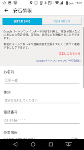
Opening status of shelters and facilities for people who have difficulty returning home in the event of a disaster, the latest information by push notification, safety notification using SNS and Google Person Finder, flood and inundation hazard map information, disaster prevention guide in case of disaster , It is an official free application of Koto Ward that supports multiple languages (English, Chinese [simplified], Korean) with useful functions such as disaster information from the ward and security lights. Use the Koto Ward Disaster Prevention Map regularly to be prepared in case of emergency.
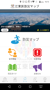
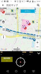
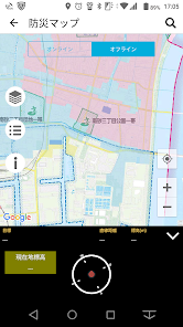
■ "Disaster prevention map"
■ "Safety information"
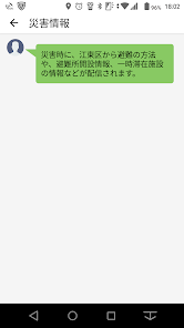
■ "Disaster information"
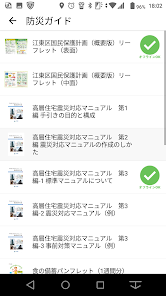
■ "Disaster prevention guide"
■ "Notice"
■ "Light"
■ "Buzzer"
■ "Links"
■ "Settings"
Android OS 7.0 or later
This application is free. There is no charge for viewing each information (communication charges for downloading the application will be charged separately).
■ "Disaster prevention map"
■ "Safety information"
■ "Disaster information"
■ "Disaster prevention guide"
■ "Notice"
■ "Light"
■ "Buzzer"
■ "Links"
■ "Settings"
Android OS 7.0 or later
This application is free. There is no charge for viewing each information (communication charges for downloading the application will be charged separately).
Updated on
Safety starts with understanding how developers collect and share your data. Data privacy and security practices may vary based on your use, region, and age. The developer provided this information and may update it over time.

No data shared with third parties
Learn more about how developers declare sharing

No data collected
Learn more about how developers declare collection
Ratings and reviews
3.5
34 reviews
What's new
地図機能のマップ名を更新しました。