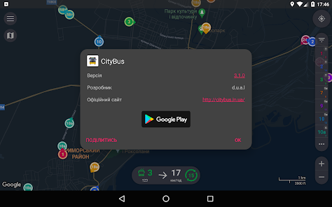
CityBus Mariupol
Contains adsIn-app purchases
3.9star
4.29K reviews
100K+
Downloads

Mature 17+
info
About this app
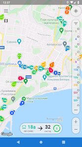
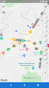
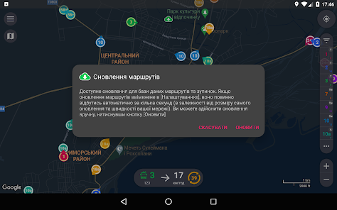
Smart app for tracking public transport of Mariupol.
* Main app function - transport tracking - depends on the functioning of an external source of GPS data. Cooperation of the source and app is not guaranteed. Also, given the significant intervals of data updates sometimes, there may be some differences between the real transport position and the one that shown in the application.
- Only actual information. CityBus filters data not to show you things, which aren't there.
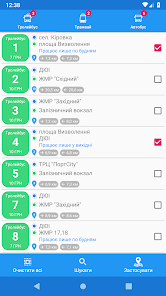
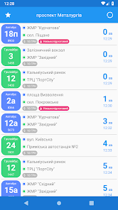
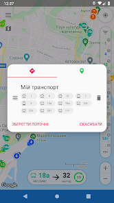
- Favourites. CityBus gives you possibility to save your favorite routes lists and apply them in just a couple of taps.
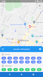
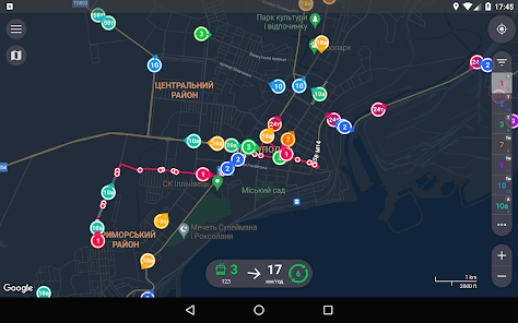
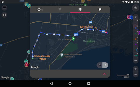
- Smart view. On map zoom in you will see all vehicles, equipped with GPS-trackers, not only of selected routes.
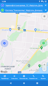
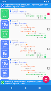
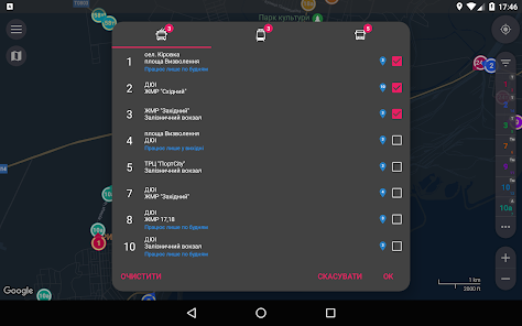
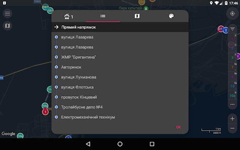
- Routes search. You only need to choose two points on a map, search results could be filtered and applied to display suitable vehicles.
- Real-time transition. Received info about coordinates, speed and heading is enough to predict with high probability real-time vehicle location. Displaying movement on a map is animated, almost no jumps.
- Traffic optimization. All useful info is already inside this app.
- Speed and heading visualization. Only one glance at map allows you to determine heading and speed of vehicles you need. Depending on speed changes size of colored area of ring around marker, and its center points in a direction the bus is heading.
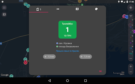
- Color routes identification. Distinguishing routes is quite easy, 'cause every selected route is determined not only by its number, but although by color of its marker.
Application uses open data from web-site Martrans (https://martrans.gov.ua/) on the basis of the Law of Ukraine "About access to public information"
* Main app function - transport tracking - depends on the functioning of an external source of GPS data. Cooperation of the source and app is not guaranteed. Also, given the significant intervals of data updates sometimes, there may be some differences between the real transport position and the one that shown in the application.
- Only actual information. CityBus filters data not to show you things, which aren't there.
- Favourites. CityBus gives you possibility to save your favorite routes lists and apply them in just a couple of taps.
- Smart view. On map zoom in you will see all vehicles, equipped with GPS-trackers, not only of selected routes.
- Routes search. You only need to choose two points on a map, search results could be filtered and applied to display suitable vehicles.
- Real-time transition. Received info about coordinates, speed and heading is enough to predict with high probability real-time vehicle location. Displaying movement on a map is animated, almost no jumps.
- Traffic optimization. All useful info is already inside this app.
- Speed and heading visualization. Only one glance at map allows you to determine heading and speed of vehicles you need. Depending on speed changes size of colored area of ring around marker, and its center points in a direction the bus is heading.
- Color routes identification. Distinguishing routes is quite easy, 'cause every selected route is determined not only by its number, but although by color of its marker.
Application uses open data from web-site Martrans (https://martrans.gov.ua/) on the basis of the Law of Ukraine "About access to public information"
Updated on
Safety starts with understanding how developers collect and share your data. Data privacy and security practices may vary based on your use, region, and age. The developer provided this information and may update it over time.


Ratings and reviews
3.9
4.22K reviews

A Google user
- Flag inappropriate
October 9, 2019
Что с выбором языков? Какой бы не выбрал приложение на английском еще и фиксы льете не тестировав, мда...
1 person found this review helpful
d.u.a.l
October 10, 2019
Будь-який адекватний розробник знає, що покрити тестами баги, які виникають в окремих юзерів на окремих моделях телефонів/прошивок і т.д. - нереально. Баг некритичний, аж у 2 користувачів з кількох тисяч. Чи мені його треба було залишити, щоб вам спокійніше було? Стосовно мови - певно, дається взнаки відсутність периферійного пристрою "прямі руки"
A Google user
- Flag inappropriate
- Show review history
August 30, 2018
Absolutely nice
2 people found this review helpful
d.u.a.l
August 30, 2018
👍👍👍
A Google user
- Flag inappropriate
- Show review history
August 20, 2018
The map stops refreshing after few days of normal working. Reinstalling the
app doesn't help.
1 person found this review helpful
d.u.a.l
August 21, 2018
Сірієслі? Я теж вмію користуватись Google Tranlate, але навіщо цей цирк? Якщо у вас таки перестав показуватись транспорт, то певно вас забанили на МарТрансі 😀 Іншого варіанту я не бачу. Ну хіба крім того, що раз відгук написаний вночі, то транспорт вночі не їздить. Можете спробувати змінити мережу мобільну на Wi-Fi or vice versa
What's new
- The direction indicator of the transport markers coincides with the direction of its movement along the route scheme. The direction obtained from the vehicle is still available as an arrow in the information area, which appears when you click on the marker
- Ability to change size of stop markers using the corresponding [Preferences] item
- Number of selected routes for each transport type in the route selection window and on the [Routes] screen
- Ability to change size of stop markers using the corresponding [Preferences] item
- Number of selected routes for each transport type in the route selection window and on the [Routes] screen


