Thank you for using Mapinr. The ever faster life cycles of Android versions make it difficult for non-profit projects to survive. Nevertheless, we will keep this project alive and follow our vision to provide a secure, privacy-friendly and very affordable app.
We recognise that G requires a minimum Android version, which many devices do not support. We offer downloads for previous Android versions, not supported by the Play Store anymore, on our website.
Do you want to view and manage your own points of interest? Are you searching for an app to put your pictures on a map?
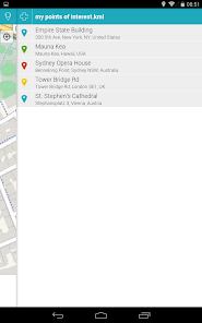
MAPinr is a simple (ad-free) Android app that allows you to manage your kml/kmz files and display your gpx files on different maps. MAPinr is perfect for professional use but also hiking, cycling, running, skiing, etc.
Please let us know your problems and ideas on how to improve MAPinr (app@farming.software). Don't be rude just because we do not provide some functionality you were looking for. Instead drop us an email with your thoughts and suggestions. We know that software bugs can be highly frustrating. Please be patient and accept that our limited resources do not allow us to implement all suggestions.
MAPinr provides the following functionality:
1. Ad free / No ads
2. Hierarchical folder structure for managing multiple kml/kmz/gpx files
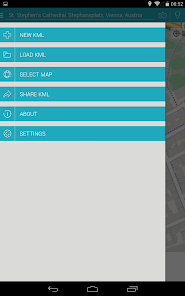
3. Create, load, edit, save, import, export and share kml/kmz files
4. Create, load, edit, save, import, export and share waypoints, lines/tracks and polygons
5. Add pictures to your waypoints (to create photomaps)
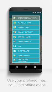
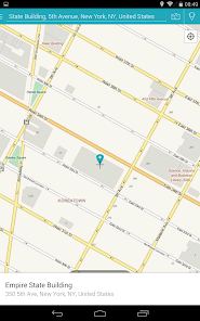
6. Display waypoints, lines/tracks and polygons on different maps (Maps, Satellite, Hybrid, OpenStreetMap, Opentopomap, Opencyclemap)
7. Share coordinates of waypoints
8. Individually colorize waypoints, lines/tracks and polygons
9. Open exported kml/kmz files in other apps
10. Search by name, address and coordinates
11. Location-sharing to let your friends know where you are
12. Display multiple kml/kmz/gpx files simultaneously
13. Merge kml/kmz files
14. Cloud integration
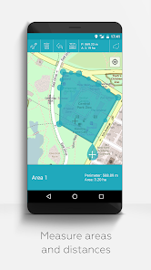
15. Measure distances and areas on your map
16. Multilanguage (currently English, Spanish, Lithuanian, Polish)
Extended features (For free with donations or like on LInkedIN; activate in Settings):
1. Download maps for free / Offline maps (openstreetmap)
2. GPX viewer (GPX files can only be displayed!)
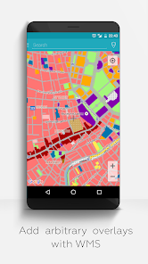
3. Display arbitrary map data using Web Map Service (WMS), e.g., Opendata from www.data.gov
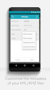
4. Create custom metadata
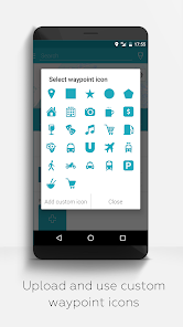
5. Upload and use custom icons
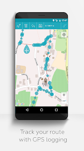
6. Record GPS tracks
Compared to related apps MAPinr will not sniff into your private data or even sell it. Please note that donations are a free contribution to support our non-profit work.