The “São Paulo Metro - Official” application is the quickest way to map and plan your route to appointments and engagement around São Paulo using the Metro system.
The application is an initiative of the São Paulo Metropolitan Rail Company - METRO.
Functions and resources:
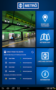
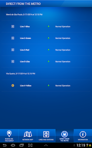
- Direct from the Metro Real-time tracking of each line’s operational status.
- Where are you going? A step-by-step simulation of the fastest route between two stations, including estimated time and cost, neighborhood maps, etc.
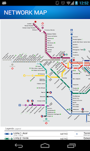
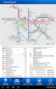
- Network Map Visual map of all Metro lines.
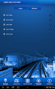
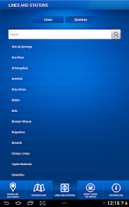
- Lines and Stations View all Metro lines and stations. Consult operating hours, locations, etc.
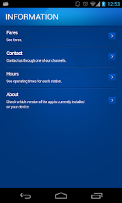
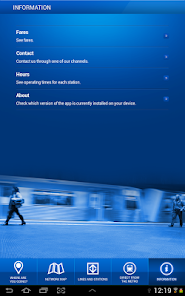
- Information View fares, assistance telephone numbers, and service hours for individual stations.
Updated on
Feb 23, 2024
Maps & Navigation
Data safety
arrow_forward
Safety starts with understanding how developers collect and share your data. Data privacy and security practices may vary based on your use, region, and age. The developer provided this information and may update it over time.