
Portal for Assets & Navigation
100+
Downloads

Everyone
info
About this app
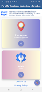
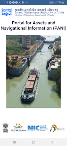
PANI is an integrated solution bringing river navigation and Infrastructure information on a single platform. The open access platform brings transparency of information for timely decision making based on single source of truth and aims to facilitate transportation of cargo and other vessels through inland waterways. The GIS map-based portal also helps external stakeholders in voyage planning, leading to ease of business.
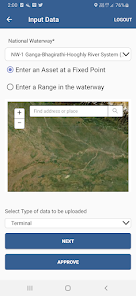
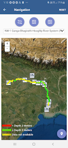
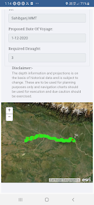
PANI provides detailed information on various features of the National Waterways (NWs) and the terminal assets on this NWs, such as fairway (LAD, etc.), infrastructure facility (jetties, pontoons, cargo handling equipment, storage facilities), cross river structures (bridge locations locks, barrages), connectivity at jetties, emergency services for facilitating transportation of cargo and other vessels through inland waterways. For better understanding of above information & navigation visually the portal uses GIS based Bharat maps. The portal helps users in assessing the feasibility of transportation on an anticipated date of journey by simulating historical data against required draught, vertical and horizontal clearance.
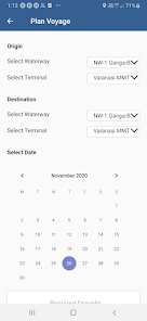
With such geographical extends of NWs; PANI helps manage key information on nearly real time basis. The interactive dashboards and reports allow internal stakeholders to informed & timely decision. PANI increases the ease of business on inland waterways through single window for voyage planning and permission.
PANI provides detailed information on various features of the National Waterways (NWs) and the terminal assets on this NWs, such as fairway (LAD, etc.), infrastructure facility (jetties, pontoons, cargo handling equipment, storage facilities), cross river structures (bridge locations locks, barrages), connectivity at jetties, emergency services for facilitating transportation of cargo and other vessels through inland waterways. For better understanding of above information & navigation visually the portal uses GIS based Bharat maps. The portal helps users in assessing the feasibility of transportation on an anticipated date of journey by simulating historical data against required draught, vertical and horizontal clearance.
With such geographical extends of NWs; PANI helps manage key information on nearly real time basis. The interactive dashboards and reports allow internal stakeholders to informed & timely decision. PANI increases the ease of business on inland waterways through single window for voyage planning and permission.
Updated on
Data safety
Developers can show information here about how their app collects and uses your data. Learn more about data safety

No information available
What's new
new app


