E-WALK
E-walk allows you to find your next outdoor activity, plan it, and record it. E-walk is the perfect companion for outdoors activities (such as hiking, trekking, biking, fishing, hunting, etc...) and for traveling abroad, because you can fully use it offline.
Lost in a forest? E-walk brings you back to your car. Forgot about where was this lovely boutique you noticed last year in Venice? E-walk refreshes your memory!
E-WALK KEY FEATURES
• worldwide high resolution topographic map (E-walk Topo Map), designed for hiking and outdoors activities
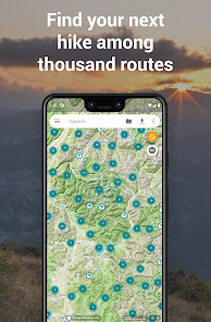
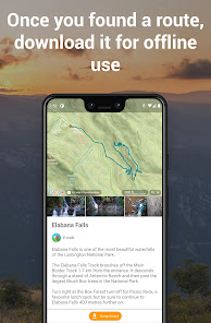
• find your next adventure among thousand routes, download them for offline use and share yours (requires a free E-walk account)
• full integration of IGNrando' (https://ignrando.fr): browse IGNrando' routes on the map, sync your IGNrando' content, upload routes to IGNrando' (requires a free IGNrando' account)
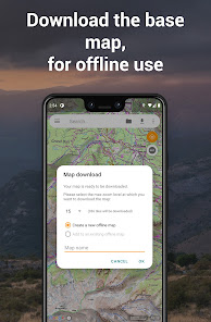
• download maps for later offline use (free for OpenStreetMap and Wikimedia Maps, with subscription for E-walk Topo Map)
• show your current location on the map
• search places (last searches are saved for offline use)
• record your hikes
• select different base maps (streets, satellite, terrain, etc...)
• plan your hikes by creating and editing KML files on the map. A KML file can contains markers, lines & polygons
E-WALK ADVANCED FEATURES
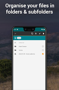
• organize your hikes in folders & subfolders
• display overlay maps (weather, roads, metro/bus, ski slopes, sea map, etc...)
• share your position via e-mail or SMS
• open a position in your other geo apps (such as Google Maps, Waze, TomTom, Sygic, Locus, Orux, MyTrails, etc...)
• share a hike by e-mail, bluetooth, etc... Either in KML file format (by default) or in GPX file format
• import GPX files (they will be converted in KMZ format)
• add custom maps in the XYZ protocol (see http://wiki.openstreetmap.org/wiki/Slippy_map_tilenames)
• add custom maps in the WMS protocol
E-WALK PLUS
E-walk has already a lot of features for free. But you can buy E-walk Plus to add the following:
• remove the ads
• have a scale on the map
• store your data on your SD card
• save / restore your data
• support E-walk's development
E-WALK MAX
E-walk Max unlocks all features of the app (excluding IGN Maps plugin). You can try it for free during 3 days. It includes all the advantages of E-walk Plus, and the following:
• download E-walk Topo Map for offline use
• pause your hikes recordings
IGN MAPS PLUGIN
The IGN maps plugin (https://play.google.com/store/apps/details?id=com.at.ewalk.plugin.ign) adds maps provided by the french national institute of geographical and forestry information (http://www.ign.fr).
CONTACT
A problem with E-walk? A suggestion? A feedback? Please do not hesitate to send an e-mail to contact@ewalk.app!