
AR AlpineGuide
Contains ads

3.6star
2.3K reviews
500K+
Downloads

Everyone
info


About this app
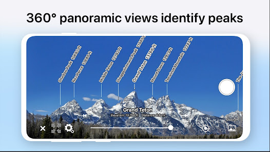
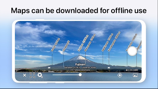
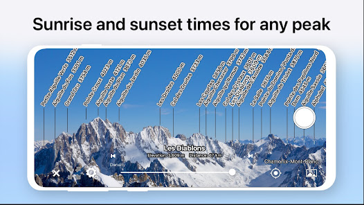
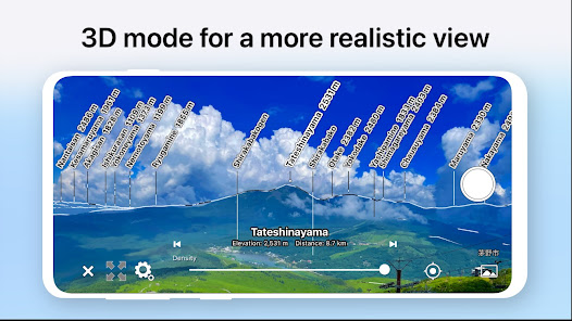
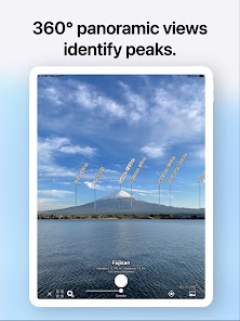
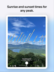
Point your Android device at the mountain and you'll see the peak's name, altitude, and distance!
This app has been renamed from "AR Map World Peaks".
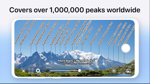
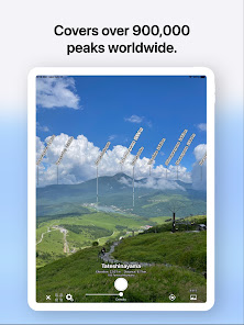
■ It has data from nearly one million peaks around the world.
■ Even if you tilt the camera, the name is displayed on the mountaintop using 3D coordinates and a gyroscope, so it is easy to check.
■ Since the guideline of the same shape as the ridgeline is displayed, you can accurately match the position of the mountaintop.
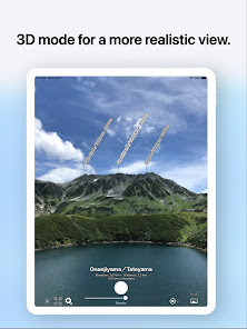
■ Point your Android device down to switch to a 3D view overlooking the sky.
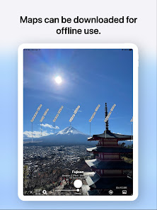
■ You can check the terrain and mountain names that can be seen from the specified location on the map.
■ You can take a picture with the name of the mountain and share it on SNS or email.
■ Swipe to adjust the position of the mountain name.
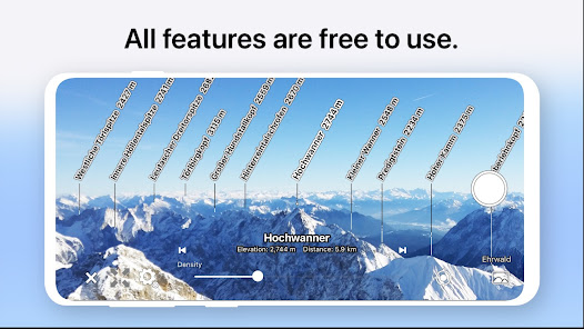
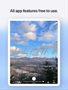
■ All features are free!
* If the direction is incorrect (such as when the north is always displayed), if the Android device has a cover, or if the case has a sensor, remove it. The metal or magnet on the cover may interfere with the sensor and cause malfunction.
This app has been renamed from "AR Map World Peaks".
■ It has data from nearly one million peaks around the world.
■ Even if you tilt the camera, the name is displayed on the mountaintop using 3D coordinates and a gyroscope, so it is easy to check.
■ Since the guideline of the same shape as the ridgeline is displayed, you can accurately match the position of the mountaintop.
■ Point your Android device down to switch to a 3D view overlooking the sky.
■ You can check the terrain and mountain names that can be seen from the specified location on the map.
■ You can take a picture with the name of the mountain and share it on SNS or email.
■ Swipe to adjust the position of the mountain name.
■ All features are free!
* If the direction is incorrect (such as when the north is always displayed), if the Android device has a cover, or if the case has a sensor, remove it. The metal or magnet on the cover may interfere with the sensor and cause malfunction.
Updated on
Safety starts with understanding how developers collect and share your data. Data privacy and security practices may vary based on your use, region, and age. The developer provided this information and may update it over time.

No data shared with third parties
Learn more about how developers declare sharing

This app may collect these data types
Location and App info and performance

Data is encrypted in transit

You can request that data be deleted
Ratings and reviews
3.5
2.26K reviews

Brenton Wiberg (brenTRON)
- Flag inappropriate
January 2, 2024
Would be really cool except that the AR festure doesn't really work. I can't get the mountain outline and labels to match up with reality.
4 people found this review helpful

Dave Bowman
- Flag inappropriate
May 15, 2021
Peaks are all in the wrong position. Cant find a way to calibrate.
25 people found this review helpful

Shyam Basnet
- Flag inappropriate
May 10, 2022
Yes I highly recommend this app to anyone's. It's really usufu on the TREKKING and mountains.
10 people found this review helpful
What's new
Fixed a bug that crashed rarely.
Updated the software libraries.
Fixed other minor issues.
Updated the software libraries.
Fixed other minor issues.


