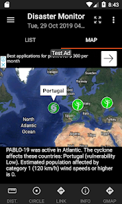
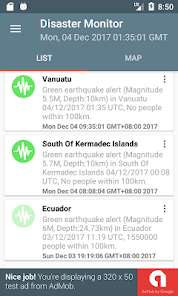
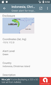
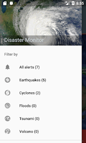
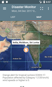
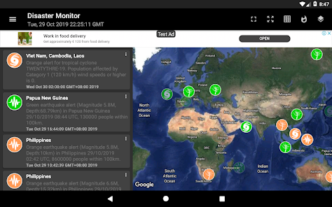
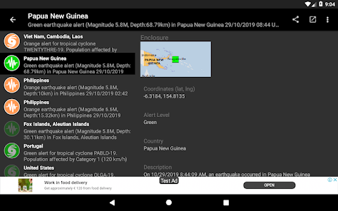
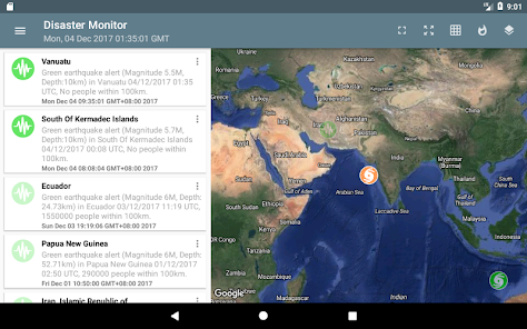
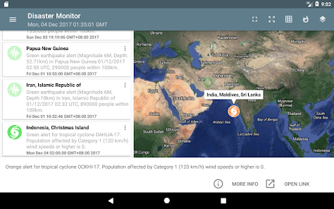
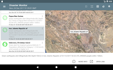
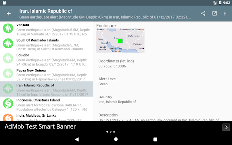
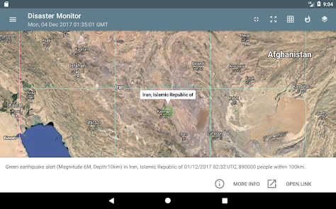
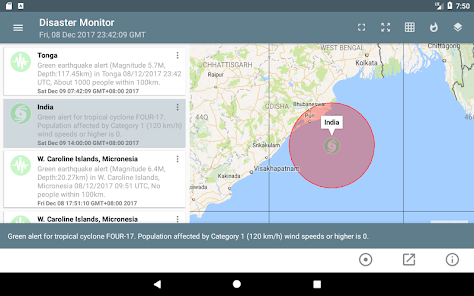
You can monitor natural disasters around the world, as published by the Global Disaster Alert and Coordination System - www.gdacs.org. The app shows the latest natural disasters like earthquakes, droughts, volcano eruptions, tropical cyclones, tsunamis and floods as color coded icons in a list as well as on a Google Maps backdrop; the icon colors indicate the alert level - green, orange, and red. The icon will look more transparent the older the event was published. Clicking on the item will bring up more details about the disaster event. UTM or geographic grids can optionally be displayed on the map.
* Now with dark mode setting.
Updated on
Mar 4, 2024
News & Magazines
Data safety
arrow_forward
Safety starts with understanding how developers collect and share your data. Data privacy and security practices may vary based on your use, region, and age. The developer provided this information and may update it over time.