Snowdonia Outdoor Map Offline
3.8star
18 reviews
5K+
Downloads

Everyone
info
About this app
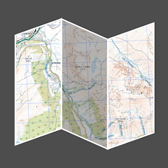
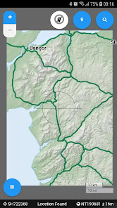
An offline map of Snowdonia National Park in Wales, ideal for hiking, running, mountain biking / cycling. Being offline means unlike other map apps, you don't need a signal to access detailed maps of the area.
Features:
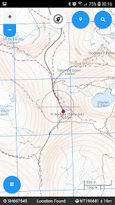
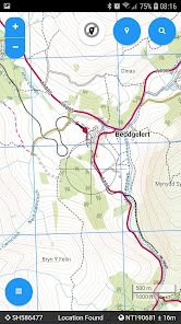
* Clearly see footpaths, tracks and contours
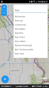
* Search for not just towns, but also lakes and hills
* Location in OS grid reference coordinates
* Find your location using your phone GPS
Features:
* Clearly see footpaths, tracks and contours
* Search for not just towns, but also lakes and hills
* Location in OS grid reference coordinates
* Find your location using your phone GPS
Updated on
Safety starts with understanding how developers collect and share your data. Data privacy and security practices may vary based on your use, region, and age. The developer provided this information and may update it over time.

No data shared with third parties
Learn more about how developers declare sharing

No data collected
Learn more about how developers declare collection
Ratings and reviews
3.8
18 reviews

Gary Hughes
- Flag inappropriate
August 21, 2022
A number of places I searched around Betws-y-Coed didn't show up. Places like the Miners Bridge, Swallow Falls and The Fairy Glen. Other places, like Tryfan, do show but I did feel there was not enough detail. Perhaps I need to zoom in more for the extra detail and place names, and may as a result try out the pro version of the app, which is reasonably priced. Nonetheless, this is still a really good app to get one's general bearings of locations and places, which is why I have awarded 4 stars.

Tony Heaney
- Flag inappropriate
September 30, 2023
Awful app, paid for the premium version, makes no difference to the workings of the app, no extra features. A con don't buy.

A Google user
- Flag inappropriate
- Show review history
September 22, 2018
Does not work....
6 people found this review helpful


