100+
Downloads

Everyone
info
About this app
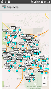
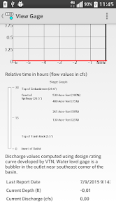
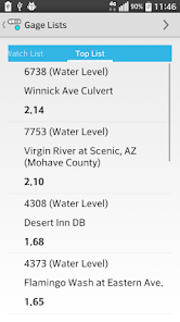
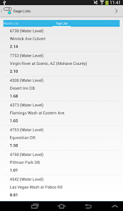
Use this app to view the network of weather gages in Clark County, Nevada.
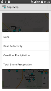
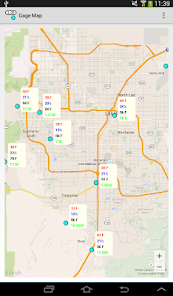
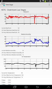
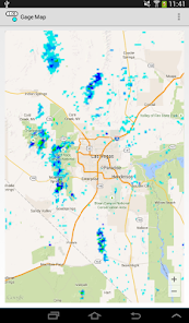
Includes the ability to view each of the different gage types, including rainfall, water level, and weather information. Add NWS radar to the map during a storm to track where rainfall could occur. Also includes the ability to focus on individual rain and water level gages to determine if an area is being inundated.
DISCLAIMER: The Regional Flood Control District collects hydrometeorologic data primarily for the purpose of detecting situations which could cause flooding. This data may not represent the official data for Las Vegas or the Clark County area.
While reasonable efforts are made to ensure that accurate and reliable data is provided, the District makes no warranties, either expressed or implied, regarding the quality of this data. All data presented here should be regarded as provisional and subject to change.
CAUTION: When connected, Gage Map receives data each minute. Significant data charges may result from delivery over a data connection. You may incur access or data fees from third parties (such as your Internet provider or mobile carrier) in connection with your use of this app.
Updated on
Safety starts with understanding how developers collect and share your data. Data privacy and security practices may vary based on your use, region, and age. The developer provided this information and may update it over time.

No data shared with third parties
Learn more about how developers declare sharing

No data collected
Learn more about how developers declare collection
What's new
Rainfall gages now work correctly
Updated disclaimer to include data usage caution
Updated disclaimer to include data usage caution