

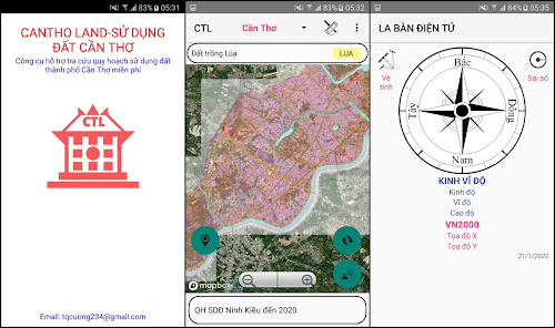
QH sử dụng đất Cần Thơ
Contains ads

10K+
Downloads

Everyone
info
About this app
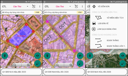
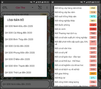
- Support to look up district use planning to 2020
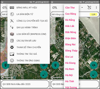
- Ninh Kieu, Cai Rang, Binh Thuy, Co Do, Phong Dien, O Mon, Vinh Thanh, Thoi Lai and Thot Not
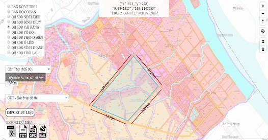
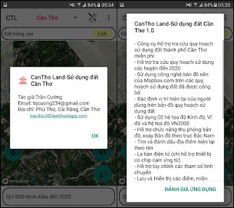
- Using Mapbox.com's base map technology on published land use plans
- Determining the user's current location on land use planning map
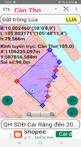
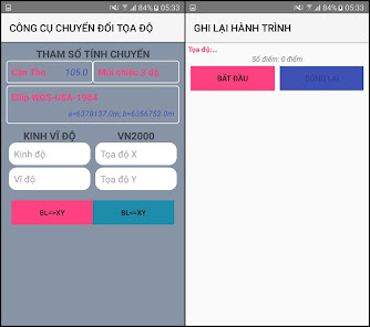
- Use 02 coordinate systems Longitude, Latitude and coordinate system VN2000
- Support map zoom function, rotate the map to the North-South axis
- Find and bookmark current locations by name
- Electronic compass (supports only devices with magnetic induction chips)
- Support to customize the transfer parameters
- Save and display points, area areas according to Objects and Projects
- Change colors, hide objects and points in the Project
- Save the free drawing area
- View, Edit, Delete, Find Landmarks
- Function guide the object, save points
- Support function to redraw survey routes over time
- Support displaying map styles from mapbox.com
- Drawing Points, Polygon Domains; Measure the Distance, calculate the Area
- Export point data to .kml .gpx file types
- Support importing point data from .gpx file
- Send and exchange data of saved points
- Support tools to convert between coordinate systems
- Ninh Kieu, Cai Rang, Binh Thuy, Co Do, Phong Dien, O Mon, Vinh Thanh, Thoi Lai and Thot Not
- Using Mapbox.com's base map technology on published land use plans
- Determining the user's current location on land use planning map
- Use 02 coordinate systems Longitude, Latitude and coordinate system VN2000
- Support map zoom function, rotate the map to the North-South axis
- Find and bookmark current locations by name
- Electronic compass (supports only devices with magnetic induction chips)
- Support to customize the transfer parameters
- Save and display points, area areas according to Objects and Projects
- Change colors, hide objects and points in the Project
- Save the free drawing area
- View, Edit, Delete, Find Landmarks
- Function guide the object, save points
- Support function to redraw survey routes over time
- Support displaying map styles from mapbox.com
- Drawing Points, Polygon Domains; Measure the Distance, calculate the Area
- Export point data to .kml .gpx file types
- Support importing point data from .gpx file
- Send and exchange data of saved points
- Support tools to convert between coordinate systems
Updated on
Safety starts with understanding how developers collect and share your data. Data privacy and security practices may vary based on your use, region, and age. The developer provided this information and may update it over time.

No data shared with third parties
Learn more about how developers declare sharing

No data collected
Learn more about how developers declare collection


