
Utah County Parcel Map
4.3star
60 reviews
5K+
Downloads

Everyone
info


About this app
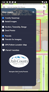
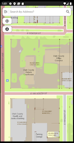
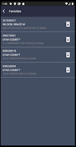
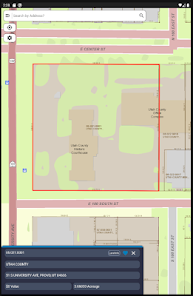
Utah County Parcel Map provides simple easy to use tools to assist you in understanding parcels and parcel ownership in Utah County. You will find an easy to use address search that will zoom the focus of the map to the corresponding address. There is also a parcel identification number search that allows the user to search for parcels by their serial number. There is also a name search that allows a user to search for parcel by owners name.
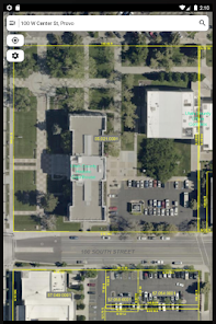
As the user zooms in closer and closer to a parcel, more data will be displayed on the map. Eventually, dimensions, descriptions, measurements, and boundaries will become clear to the user for each parcel in the county.
Information specific to each parcel comes up in a convenient call-out box when the user “clicks” on the screen.
"Mapping API provided by Esri ArcGIS Runtime API for Android"
Esri ArcGIS Online provides the World_Street_Map and World_Imagery web services used in this app.
World_Street_Map Sources: Esri, DeLorme, NAVTEQ, USGS, Intermap, iPC, NRCAN, Esri Japan, METI, Esri China (Hong Kong), Esri (Thailand), TomTom, 2012
World_Imagery Sources: Esri, DigitalGlobe, GeoEye, i-cubed, USDA, USGS, AEX, Getmapping, Aerogrid, IGN, IGP, and the GIS User Community
Updated on
Safety starts with understanding how developers collect and share your data. Data privacy and security practices may vary based on your use, region, and age. The developer provided this information and may update it over time.

No data shared with third parties
Learn more about how developers declare sharing

No data collected
Learn more about how developers declare collection