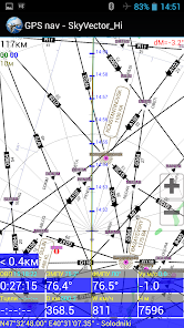
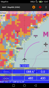
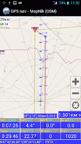
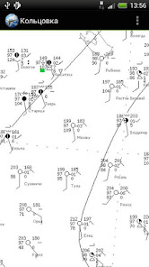
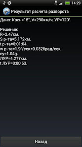
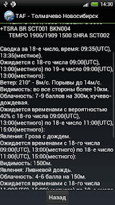
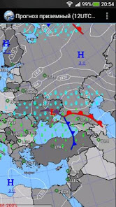
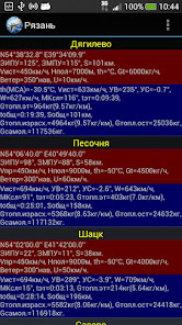
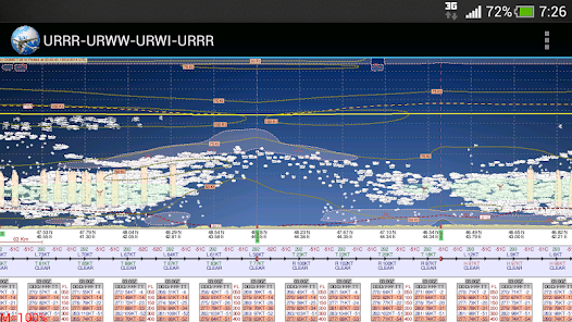
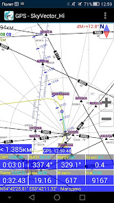
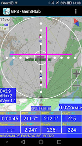
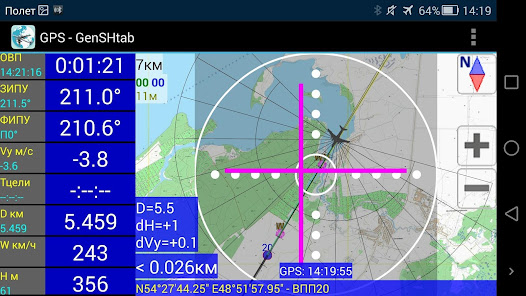
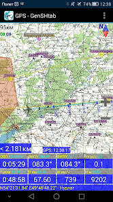
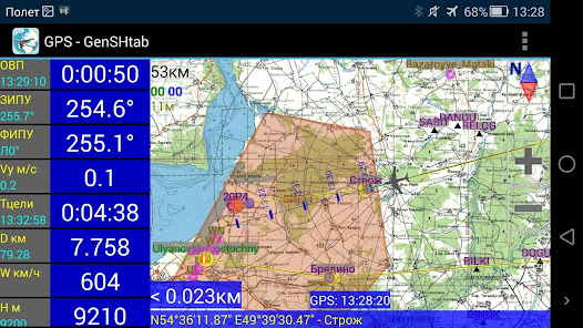
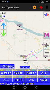
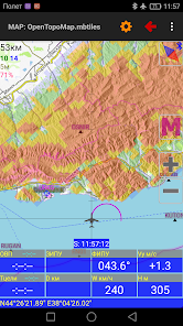
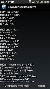
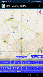
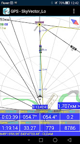
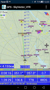
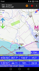
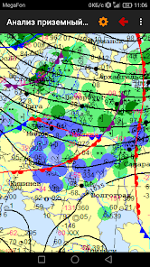
To help the workers of the sky! - Aviation GPS navigation; - GPS landing. - Calculations using GPS data. - calculation of the flight route (IHR) according to the weather forecast. - other aviation calculations; - Time calculator; - view the TAF / METAR / NOTAM reports of international airports and decode them; - viewing of area weather forecasts. - loading and viewing of weather maps, weather section along the route, meteor radar and satellite images; Help file to the program: http://navair.narod.ru/download/ProNebo_Help.pdf. Discussion at ForumAvia: http://www.forumavia.ru/a.php?a=t&id=13080. Discussion at 4PDA: http://4pda.ru/forum/index.php?showtopic=382528. Group VC: https://vk.com/club159833375
Updated on
Mar 10, 2021
Maps & Navigation
Data safety
arrow_forward
Safety starts with understanding how developers collect and share your data. Data privacy and security practices may vary based on your use, region, and age. The developer provided this information and may update it over time.