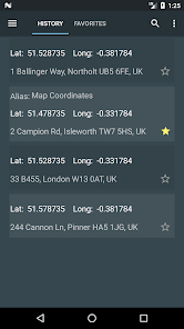
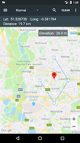
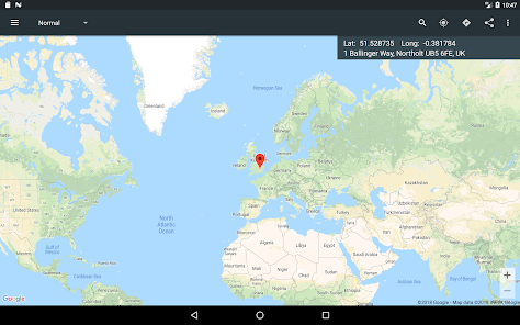
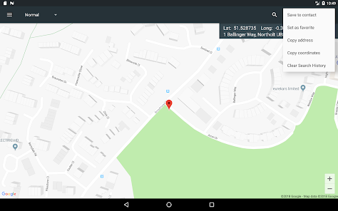
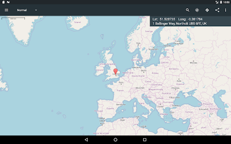
A single tap on the map gives you access to world coordinates. In addition, Map Coordinates offers a full set of tools like distance measurement, current GPS location, history / favorite locations, share location, find location or copy coordinates / address. You can switch between multiple coordinate types like decimal degrees, DMS (degrees, minutes and seconds) or even special types like what3words, MGRS, UTM or GEOREF.
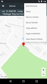
The app is designed to easily determine the coordinates and address of a point on the map and share them with friends via SMS, email or social apps.
When you need to find a location, you can either type / paste the address / coordinates in a search field or enter each coordinate value one by one in it’s own field using the advanced search options. what3words, MGRS, UTM or GEOREF can be searched for only by using the single search field.
The current GPS location is best received while the mobile device is located outdoors. The GPS satellites are easy to be found when there is no interference like buildings or clouds. Even if the device is located indoor, the location can be accurately found through WiFi network but only if the device is connected to that network.
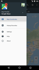
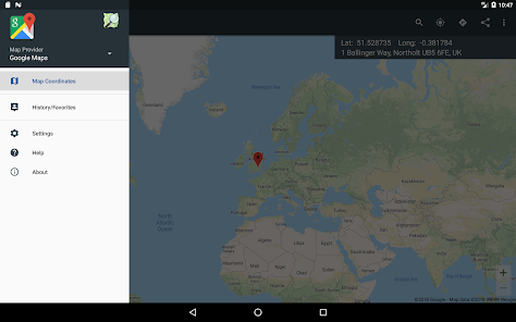
The side drawer menu is used to navigate between different parts of the app like History / Favorites but it is also used to switch the map provider. The available map providers are Google Maps and Open Street Maps, each of them having different map types. Under Open Street Maps there is also a compass available all the time.
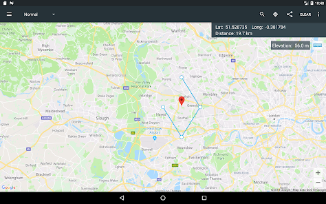
Settings can also be accessed from the side navigation drawer. There you have the options to switch between existing coordinates types, change the visibility of the address bar or you can enable the Distance measure tool and the Elevation tool. Elevation displays the altitude of the selected location on the map.
Notes: 1. GPX and KML file types are supported with certain limits: Only simple waypoints are processed for GPX files and only Placemarks are processed for KML files. 2. UTM, MGRS and GEOREF coordinates types are available as paid options
We hope that this app fulfills your needs but if you have any other expectations, please don’t hesitate to contact us and we will try to help you out.
Updated on
Feb 9, 2024
Maps & Navigation
Data safety
arrow_forward
Safety starts with understanding how developers collect and share your data. Data privacy and security practices may vary based on your use, region, and age. The developer provided this information and may update it over time.
This app may share these data types with third parties
Location, App activity and 2 others
No data collected
Learn more about how developers declare collection
Data isn’t encrypted
Data can’t be deleted
See details
'> -->
Not Found
We're sorry, the requested URL was not found on this server.