
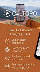
CalTopo
4.8star
1.27K reviewsinfo
100K+
Downloads

PEGI 3
info


About this app
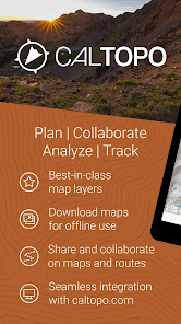
The best backcountry mapping tool on the web is now available on Android.
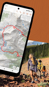
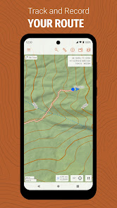
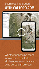
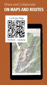
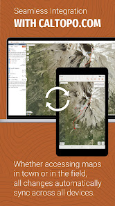
The CalTopo app integrates with your existing caltopo.com account, and edits sync between the two in seconds. Plan your trip using CalTopo's best-in-class mapping tools and then seamlessly transition to your phone. Once in the field, sync your GPS track back to caltopo.com in real time, or drop markers and instantly share them with friends.
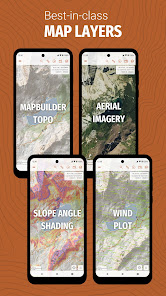
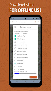
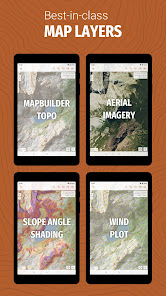
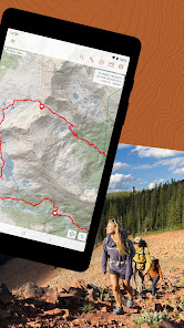
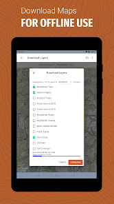
Access CalTopo layers not available elsewhere, including the MapBuilder series, land management, sun exposure, fire activity and custom terrain shading. Pre-packaged map files (subscription required) make for speedy offline downloads and simplified data management. An elevation data layer supports measuring profiles and point elevations, even when offline.
NOAA weather forecast visualizations and MODIS satellite imagery aid in-field decision making. Coming soon: SNOTEL, weather stations, streamflows and forecast grid data points.
Cloud Sync
The CalTopo app integrates with your existing caltopo.com account, and edits sync between the two in seconds. Plan your trip using CalTopo's best-in-class mapping tools and then seamlessly transition to your phone. Once in the field, sync your GPS track back to caltopo.com in real time, or drop markers and instantly share them with friends.
Amazing Maps
Access CalTopo layers not available elsewhere, including the MapBuilder series, land management, sun exposure, fire activity and custom terrain shading. Pre-packaged map files (subscription required) make for speedy offline downloads and simplified data management. An elevation data layer supports measuring profiles and point elevations, even when offline.
Real-Time Data
NOAA weather forecast visualizations and MODIS satellite imagery aid in-field decision making. Coming soon: SNOTEL, weather stations, streamflows and forecast grid data points.
Updated on
Safety starts with understanding how developers collect and share your data. Data privacy and security practices may vary based on your use, region and age The developer provided this information and may update it over time.

No data shared with third parties
Learn more about how developers declare sharing

This app may collect these data types
Location, Personal info and 4 others

Data is encrypted in transit

You can request that data be deleted
Ratings and reviews
4.8
1.19K reviews

Pearl Ward
- Flag inappropriate
15 April 2024
I'm sure I don't use this app to its full potential, but I do use it when I'm out hiking and it's such a game changer. It's basically what I've always wanted: to be able to point my phone at a mountain and be able to see the name of it and the distance and the roads and trails that are on it. How amazing is that? I love that I can also track my progress so I won't get lost, mark points if I find an ideal picnic spot I want to return to, and discover new trails. It's absolutely wonderful.
6 people found this review helpful
CalTopo LLC
24 April 2024
We love to hear that you enjoy the app. If there is anything we can do for you, just let us know at help@caltopo.com!

Alan Cook
- Flag inappropriate
11 July 2024
awesome for trip planning, sharing, and printing maps love the layering feature and how easy it is for planned tracks to snap to trails/roads
CalTopo LLC
11 July 2024
We love hearing how you use the app! Thanks for leaving a review :)

Matthew Schmidt
- Flag inappropriate
5 July 2024
Best mapping app. Excellent and continuous improvement.
CalTopo LLC
8 July 2024
The continuous improvement is largely due to feedback from users like you. Thanks for the 5-star review & thanks for using CalTopo!
What's new
Sync improvements on top of the 1.10.9 build