

AFIS Wildfire Map

3.5star
145 reviews
10K+
Downloads

Everyone
info


About this app
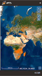
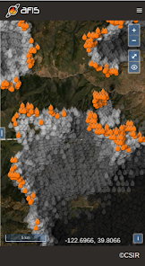
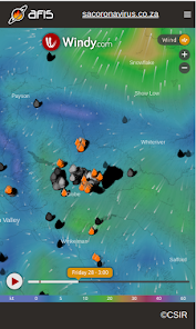
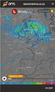
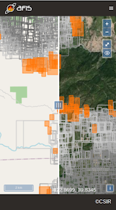
Get the latest updates on wildfire locations with the CSIR's AFIS Wildfire Map app that puts vital wildfire information at your fingertips. AFIS gives you access to fires detected globally by NASA's Terra and Aqua satellites as well as the SNPP and NOAA-20 satellites.
This app provides native access to the AFIS Viewer that is available online at https://viewer.afis.co.za/
This app replaces the previous AFIS app that was no longer maintainable. New features will be added over time.
Visit the South African Council for Scientific and Industrial Research (CSIR) website for more information about the organization behind AFIS: https://www.csir.co.za
Updated on
Safety starts with understanding how developers collect and share your data. Data privacy and security practices may vary based on your use, region and age. The developer provided this information and may update it over time.


Ratings and reviews
3.4
142 reviews

Ettienne le Roux
- Flag inappropriate
24 May 2025
Used to be an amazing app but they have changed it and removed FDI information. The API call that handles this has been offline for a number of months o their status page. I have tried contacted the contact us email but no answer, even tried contacting the team lead at CSIR but also no response from him.
5 people found this review helpful

Rodney Wainwright
- Flag inappropriate
- Show review history
3 June 2025
The app was an excellent management tool but is now not functional. They do not respond to numerous emails and do not seem to care. A great pity, going the same way as rest of SA public service!
1 person found this review helpful

L
- Flag inappropriate
16 July 2021
Doesn't give any information (size, when spotted, containment, etc.) Seems accurate on a map, but without the additional info it's mostly useless.
3 people found this review helpful
CSIR
19 July 2021
Thank you for your feedback. The app makes use of satellite data and the focus is on wide area (global) coverage rather than detailed information about each fire. Including the information you are referring to would require all responsible agencies world-wide to share information in an open and automated manner, which is unfortunately not the case.
App support
About the developer
COUNCIL FOR SCIENTIFIC AND INDUSTRIAL RESEARCH
eoapps@csir.co.za
MEIRING NAUDE RD BRUMMERIA
SILVERTON
0184
South Africa
+27 74 887 4213