ARANYA BHOOMI
10K+
Downloads

Everyone
info


About this app
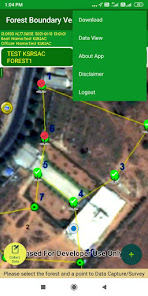
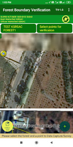
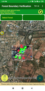
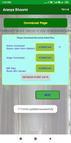
Aranya Bhoomi Mobile App is developed by Karnataka State Remote Sensing Applications Centre in association with Karnataka Forest Department to verify and confirm the forest boundaries in Karnataka State. Karnataka Forest Department use this app to collect the geotagged survey boundary stones/pillars/bandths and its demarcation status as per the notification issued by revenue and forest departments.
Updated on
Safety starts with understanding how developers collect and share your data. Data privacy and security practices may vary based on your use, region, and age. The developer provided this information and may update it over time.

This app may share these data types with third parties
Location, Photos and videos, and Device or other IDs

No data collected
Learn more about how developers declare collection

Data is encrypted in transit

Data can’t be deleted
App support
About the developer
KARNATAKA STATE REMOTE SENSING APPLICATION CENTRE
ksrsac.kgis@gmail.com
Near Horticulture College, Dept Of IT And BT, Major Sandeep Unnikrishna Road, Vidyaranyapura Post,
Bengaluru, Karnataka 560001
India
+91 96069 59410