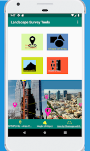
Landscape Survey Tools
Contient des annonces
1K+
Téléchargements

Tout public
info


À propos de l'application
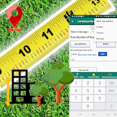
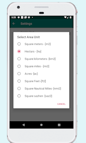
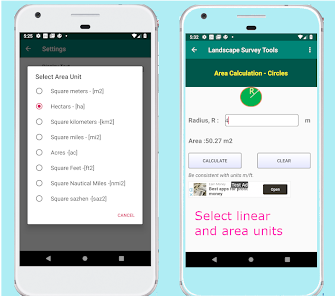
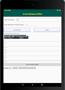
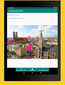
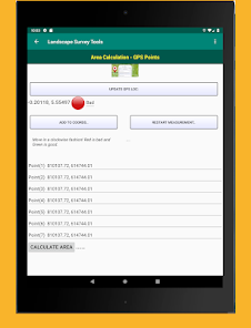
Landscape architects and other built-environment experts may need to quantify the areas encompassing all the visible features of an area of land; thought the focus is often on aesthetic appeal, it is important to have handy tools that can help to compute a few basic parameters.
Computation of areas in the appropriate units is important for any real estate developer for due diligence.
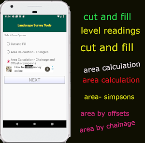
Landscape architects need to know if the slopes are good against erosion by using spot heights on the surveyors drawings.
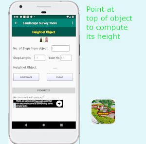
The height of an object can be determined without expensive instruments. All you need are your steps from the object and your height, accurately measured. Then you can go about finding the height of even the Eiffel Tower!!
The motivation for developing this app lies in the fact that many professionals are handicapped when it comes to certain calculations; so we have brought the solution to the ordinary man on the streets. Go on and enjoy it.
Computation of areas in the appropriate units is important for any real estate developer for due diligence.
Landscape architects need to know if the slopes are good against erosion by using spot heights on the surveyors drawings.
The height of an object can be determined without expensive instruments. All you need are your steps from the object and your height, accurately measured. Then you can go about finding the height of even the Eiffel Tower!!
The motivation for developing this app lies in the fact that many professionals are handicapped when it comes to certain calculations; so we have brought the solution to the ordinary man on the streets. Go on and enjoy it.
Date de mise à jour
La sécurité, c'est d'abord comprendre comment les développeurs collectent et partagent vos données. Les pratiques concernant leur confidentialité et leur protection peuvent varier selon votre utilisation, votre région et votre âge. Le développeur a fourni ces informations et peut les modifier ultérieurement.

Aucune donnée partagée avec des tiers
En savoir plus sur la manière dont les développeurs déclarent le partage

Aucune donnée collectée
En savoir plus sur la manière dont les développeurs déclarent la collecte

Les données sont chiffrées lors de leur transfert
Nouveautés
Handles App crashes on lower android versions and a few bugs removed.
Assistance de l'appli
phone
Numéro de téléphone
+233242828484
À propos du développeur
Franz Tette Okyere
space.infotechltd@gmail.com
Ghana
undefined


