
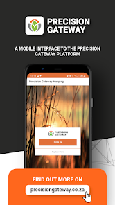
Precision Gateway
1ହ+
ଡାଉନଲୋଡ

ସମସ୍ତେ
info
ଏହି ଆପ୍ ବିଷୟରେ
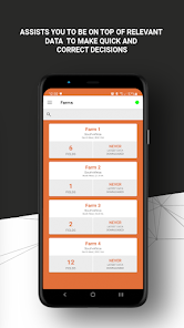
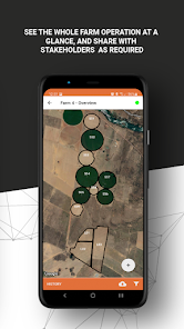
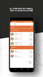
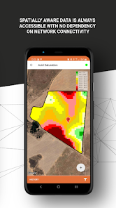
Precision Gateway Mapping is the mobile version for managing spatial data within the SGS Precision Gateway platform. The mapping app gives you access to all the geospatial data gathered on the farm, including:
• Soil physical maps
• Soil chemical maps
• Yield maps
• VRT maps
• Satellite imagery
• Nutrient Index maps
Interaction with the data is made possible by using your devices’ GPS coordinates, enabling a new dimension of working with the data.
Registration on the app is required in order for us to provide a username and password. Once the registration is received, our operators will be in contact to further assist.
ଗତ ଅପଡେଟର ସମୟ
ଡେଭେଲପରମାନେ ଆପଣଙ୍କ ଡାଟାକୁ କିପରି ସଂଗ୍ରହ ଏବଂ ସେୟାର କରନ୍ତି ସେହି ଧାରଣା ସହିତ ସୁରକ୍ଷା ଆରମ୍ଭ ହୁଏ। ଆପଣଙ୍କ ବ୍ୟବହାର, ଅଞ୍ଚଳ ଏବଂ ବୟସ ଆଧାରରେ, ଡାଟା ଗୋପନୀୟତା ଓ ସୁରକ୍ଷା ପ୍ରାକ୍ଟିସ ଭିନ୍ନ ହୋଇପାରେ। ଡେଭେଲପର ଏହି ସୂଚନା ପ୍ରଦାନ କରିଛନ୍ତି ଏବଂ ସେ ସମୟାନୁସାରେ ଏହାକୁ ଅପଡେଟ କରିପାରନ୍ତି।

ତୃତୀୟ ପକ୍ଷଗୁଡ଼ିକ ସହ କୌଣସି ଡାଟା ସେୟାର କରାଯାଇନାହିଁ
ଡେଭେଲପରମାନେ କିପରି ସେୟାରିଂର ଘୋଷଣା କରନ୍ତି ସେ ବିଷୟରେ ଅଧିକ ଜାଣନ୍ତୁ

ଏହି ଆପ ଏହି ପ୍ରକାର ଡାଟା ସଂଗ୍ରହ କରିପାରେ
ଲୋକେସନ, ବ୍ୟକ୍ତିଗତ ସୂଚନା ଏବଂ ଅନ୍ୟ 4ଟି

ଟ୍ରାଞ୍ଜିଟ ସମୟରେ ଡାଟା ଏନକ୍ରିପ୍ଟ କରାଯାଇଥାଏ

ଡାଟା ଡିଲିଟ କରିଦିଆଯାଉ ବୋଲି ଆପଣ ଅନୁରୋଧ କରିପାରିବେ
ନୂଆ କଣ ଅଛି
- Map Rework
ଆପ ସପୋର୍ଟ
ଡେଭେଲପରଙ୍କ ବିଷୟରେ
IDEAL IT DEVELOPMENT SOLUTIONS (PTY) LTD
jj@idealsolution.co.za
3 KWIKKIE ST HEUWELSIG
POTCHEFSTROOM
2531
South Africa
+27 82 929 8794