
World History Maps: The World

1ହ+
ଡାଉନଲୋଡଗୁଡ଼ିକ

PEGI 3
info


ଏହି ଆପ୍ ବିଷୟରେ
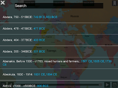
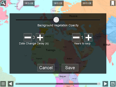
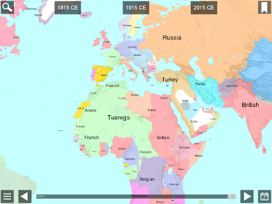
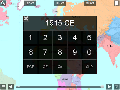
World History Maps: The World, by World History Maps Inc, is a new and unique way of looking at history. Instead of an historical atlas which has maps showing the world (or a region) at a few significant years, or maps that try to compress decades or even centuries of change on to one map, we offer a different approach. Our interactive historical maps show the entire world for every single year in recorded history. This is an unprecedented amount of detail in time for the whole world that cannot be found anywhere else. The scalable maps allow even the smallest countries to be shown. Looking at History in this detail gives one a unique perspective. These are also the first historical maps to be made using GIS technology. Maps show countries of the world at the beginning of each year, with Major Tribes and Peoples. Maps are Scaleable and zoomable with popup information. Scrolling forward and backward is available with adjustable speeds. Maps can be pinned so you can toggle back and forth to compare different years. Following below are more details about how to use the apps.
ଗତ ଅପଡେଟର ସମୟ
ଡେଭେଲପରମାନେ ଆପଣଙ୍କ ଡାଟାକୁ କିପରି ସଂଗ୍ରହ ଏବଂ ସେୟାର କରନ୍ତି ସେହି ଧାରଣା ସହିତ ସୁରକ୍ଷା ଆରମ୍ଭ ହୁଏ। ଆପଣଙ୍କ ବ୍ୟବହାର, ଅଞ୍ଚଳ ଏବଂ ବୟସ ଆଧାରରେ, ଡାଟା ଗୋପନୀୟତା ଓ ସୁରକ୍ଷା କାର୍ଯ୍ୟପଦ୍ଧତିଗୁଡ଼ିକ ଭିନ୍ନ ହୋଇପାରେ। ଡେଭେଲପର ଏହି ସୂଚନା ପ୍ରଦାନ କରିଛନ୍ତି ଏବଂ ସେ ସମୟାନୁସାରେ ଏହାକୁ ଅପଡେଟ କରିପାରନ୍ତି।

ତୃତୀୟ ପକ୍ଷଗୁଡ଼ିକ ସହ କୌଣସି ଡାଟା ସେୟାର କରାଯାଇନାହିଁ
ଡେଭେଲପରମାନେ କିପରି ସେୟାରିଂର ଘୋଷଣା କରନ୍ତି ସେ ବିଷୟରେ ଅଧିକ ଜାଣନ୍ତୁ

କୌଣସି ଡାଟା ସଂଗ୍ରହ କରାଯାଇନାହିଁ
ଡେଭେଲପରମାନେ କିପରି ସଂଗ୍ରହର ଘୋଷଣା କରନ୍ତି ସେ ବିଷୟରେ ଅଧିକ ଜାଣନ୍ତୁ
ନୂଆ କଣ ଅଛି
Geographic labels
64-bit Android support
Maps through 2020
Bug fixes and improvements
64-bit Android support
Maps through 2020
Bug fixes and improvements