
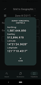
Survey Horizontal Controls
১০০+
ডাউনল’ড

সকলো
info
এই এপ্টোৰ বিষয়ে
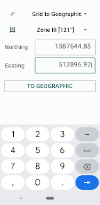
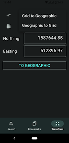
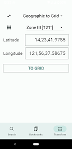
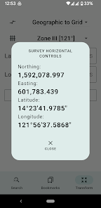
A database of commonly used Philippine survey reference points, grouped by region. This app is useful for geodetic engineers, cartographers, CAD users, and real property consolidators who need to plot parcels of land in the correct projection (LPCS, Grid, or PRS'92).
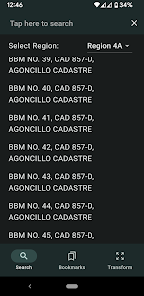
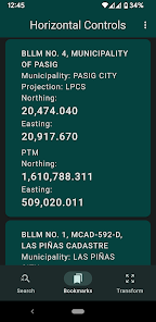
Search for the correct Northings and Eastings (y and x coordinates) of BLLMs, MBMs, BBMs, cadastral reference monuments, and more. Simply tap the magnifying glass icon, select the region where the reference point is located, and enter the monument number and survey/cadastral number to find it.
(Note for rooted Android device users: This app will not run on rooted device.)
আপডে’ট কৰা তাৰিখ
বিকাশকৰ্তাসকলে আপোনাৰ ডেটা কেনেকৈ সংগ্ৰহ আৰু শ্বেয়াৰ কৰে সেয়া বুজি পোৱাৰ জৰিয়তে সুৰক্ষা আৰম্ভ হয়। ডেটাৰ গোপনীয়তা আৰু সুৰক্ষা প্ৰণালী আপোনাৰ ব্যৱহাৰ, অঞ্চল আৰু বয়সৰ ওপৰত ভিত্তি কৰি ভিন্ন হ’ব পাৰে। বিকাশকৰ্তাগৰাকীয়ে এই তথ্যখিনি প্ৰদান কৰিছে আৰু সময়ৰ লগে লগে এয়া আপডে’ট কৰিব পাৰে।

