
ATAK Plugin: TAKSat
1 hilj.+
Preuzimanja

Svako
info
O aplikaciji
ATTENTION: This is an ATAK Plugin. To use this extended capability, the ATAK baseline must be installed. Download the ATAK baseline here: https://play.google.com/store/apps/details?id=com.atakmap.app.civ
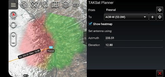
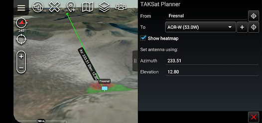
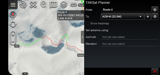
The TAKSat Planner tool calculates the Azimuth and Elevation required to achieve communication with a Geostationary satellite.
When available, it uses Digital Terrain Elevation Data (DTED) to determine terrain masking and whether communications are likely to be achieved. This can be from a fixed point or along a route. The tool can also generate a heatmap around a selected ground location to determine where in the local area communications are likely to be achievable from.
The plugin is pre-loaded with Immarsat BGAN satellites but users are able to quickly add other satellites.
A PDF manual for the plugin can be found at -> "Settings/Tool Preferences/Specific Tool Preferences/TAKSat Planner Preferences".
Best efforts are being made to keep the Open Beta Testing of this plugin updated to the same version as ATAK-CIV. Therefore if this plugin is outdated compared to your ATAK installation please consider signing up as a Beta Tester. Unfortunately, whilst feedback is appreciated, we can give no guarantees that requested features will be implemented.
Ažurirano dana
Sigurnost počinje razumijevanjem na koji način programeri prikupljaju i dijele vaše podatke. Privatnost podataka i sigurnosne prakse se mogu razlikovati ovisno o korištenju, regiji i dobi. Programer je pružio ove informacije i može ih s vremenom ažurirati.

Podaci se ne dijele s trećim stranama
Saznajte više o načinu na koji programeri pružaju izjavu o dijeljenju

Podaci se ne prikupljaju
Saznajte više o načinu na koji programeri pružaju izjavu o prikupljanju
Šta ima novo
Initial release of geostationary satellite planner for ATAK


