Путеводитель "Национальный пар
10K+
Downloads

Everyone
info

About this app
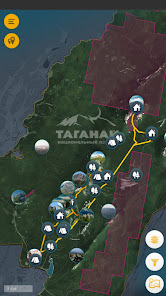
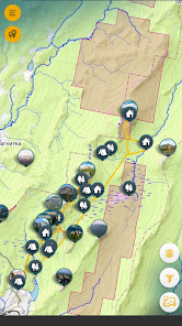
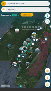
Mobile guide to the Taganay National Park.
It is a convenient tool for navigating the picturesque territory of the national park.
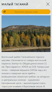
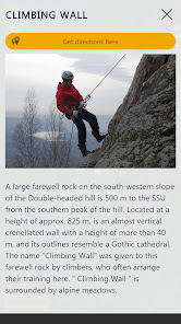
Allows you to get acquainted with the location: mountain peaks, resting sites, shelters, laid routes.
Recommended for installation on mobile devices for all potential visitors.
With the help of this software product, you will be able to determine the route to follow in the hike, and save you from the danger of getting lost in an unfamiliar area.
Ideal when planning a trip and irreplaceable during the entire trip to Taganay.
Application functions:
Offline (Without access to the Internet)
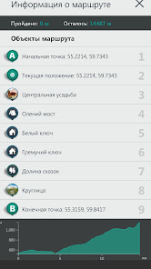
1. Information about objects
2. Photo gallery
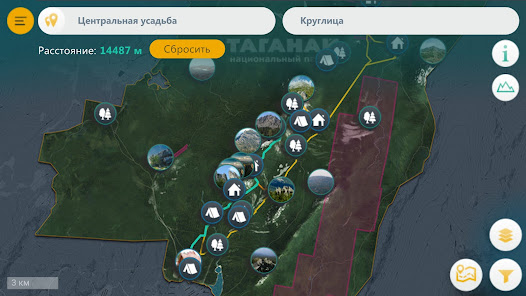
3. Main cartographic layer
4. Locating
5. Distance measurement
6. Getting the current coordinates
7. Scanning QR codes located on the territory
Online (Internet access)
1. Cartographic layers
2. Building a plot of heights
3. Weather information
It is a convenient tool for navigating the picturesque territory of the national park.
Allows you to get acquainted with the location: mountain peaks, resting sites, shelters, laid routes.
Recommended for installation on mobile devices for all potential visitors.
With the help of this software product, you will be able to determine the route to follow in the hike, and save you from the danger of getting lost in an unfamiliar area.
Ideal when planning a trip and irreplaceable during the entire trip to Taganay.
Application functions:
Offline (Without access to the Internet)
1. Information about objects
2. Photo gallery
3. Main cartographic layer
4. Locating
5. Distance measurement
6. Getting the current coordinates
7. Scanning QR codes located on the territory
Online (Internet access)
1. Cartographic layers
2. Building a plot of heights
3. Weather information
Updated on
Safety starts with understanding how developers collect and share your data. Data privacy and security practices may vary based on your use, region, and age. The developer provided this information and may update it over time.

No data shared with third parties
Learn more about how developers declare sharing

No data collected
Learn more about how developers declare collection
What's new
Обновлены объекты: ru-RU