
RO-BERTA Hagelabwehr
10K+
Downloads

Everyone
info


About this app
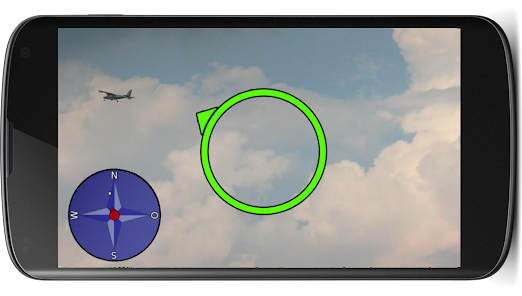
The RO BERTA project supports the hail suppression in rosenheimer environment. Users of the app can find the hail airmen in the sky or display the history of the flight on a map. In addition, users can us to evaluate better the hail flights and analyze using supported weather reports.
The field of application covers an area of 4,400 square kilometers.
It covers the city and the district of Rosenheim, the counties Miesbach and Traunstein and since 2000 More than 13 neighboring municipalities of the district Kufstein on the Austrian side.
The field of application covers an area of 4,400 square kilometers.
It covers the city and the district of Rosenheim, the counties Miesbach and Traunstein and since 2000 More than 13 neighboring municipalities of the district Kufstein on the Austrian side.
Updated on
Safety starts with understanding how developers collect and share your data. Data privacy and security practices may vary based on your use, region, and age. The developer provided this information and may update it over time.

No data shared with third parties
Learn more about how developers declare sharing

This app may collect these data types
Location, Personal info and Photos and videos

Data is encrypted in transit

You can request that data be deleted
What's new
- Absturz beim Laden der Live-Bilder behoben