
GPSeasy
100+
Downloads

Everyone
info


About this app
GPSeasy is a full featured surveying app for digital surveying with a GNSS receiver.
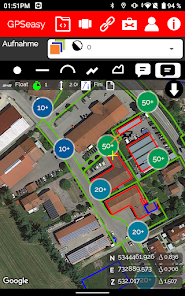
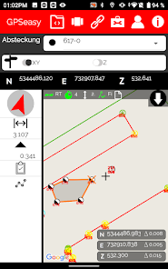
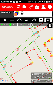
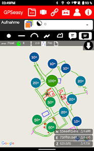
The main function of the app is measuring points, lines and areas. Besides, they also have the option to save information, attributes and photos.
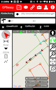
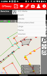
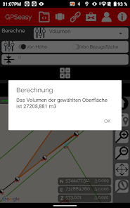
Another important feature of GPSeasy is stakeout. Here you can be navigated to existing objects and pin them down to a few centimeters with your GNSS antenna. Calculations for volumes, areas, axes and much more can be automatically performed directly on your tablet in the app.
The main interfaces of GPSeasy are -dxf, -txt and is compatible with all CAD and GIS systems.
These functions make GPSeasy ideal for a wide range of applications: GPSeasy was developed for GIS applications, the municipal sector, construction surveying and engineering surveying.
The main function of the app is measuring points, lines and areas. Besides, they also have the option to save information, attributes and photos.
Another important feature of GPSeasy is stakeout. Here you can be navigated to existing objects and pin them down to a few centimeters with your GNSS antenna. Calculations for volumes, areas, axes and much more can be automatically performed directly on your tablet in the app.
The main interfaces of GPSeasy are -dxf, -txt and is compatible with all CAD and GIS systems.
These functions make GPSeasy ideal for a wide range of applications: GPSeasy was developed for GIS applications, the municipal sector, construction surveying and engineering surveying.
Updated on
Safety starts with understanding how developers collect and share your data. Data privacy and security practices may vary based on your use, region, and age. The developer provided this information and may update it over time.

No data shared with third parties
Learn more about how developers declare sharing

This app may collect these data types
Personal info and App activity

Data is encrypted in transit

Data can’t be deleted


