Soutukaveri - Soutukartat
In-app purchases
500+
Downloads

Everyone
info
About this app
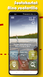
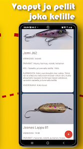
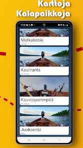
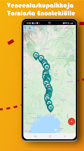
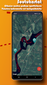
Comprehensive rowing maps for the Tornionjoki and Muonionjoki rivers. Boat moorings along the river. The free section has one rowing map and a boat landing place where the user can verify the operation of the app on their own device. A guide that recommends the fisherman which wobble or lure to the end of the line on the next landing. A traditional fish calendar that shows fish activity on different days and times of the day.
Features:
* Rowing maps
* Information on fishing areas
* Information about rowing areas
* List of boat ramps
* Weather information for the area and current location of each rowing map
* Wobbler selection guide
* Fish calendar template "Now grabs"
* View your location and track your location
Locked maps and a full list of boat landing sites can be opened in the paid section.
Updated on
Safety starts with understanding how developers collect and share your data. Data privacy and security practices may vary based on your use, region and age The developer provided this information and may update it over time.

This app may share these data types with third parties
Location

No data collected
Learn more about how developers declare collection

Data isn’t encrypted
Data can’t be deleted