
SatOrbit
4.2star
296 reviews
10K+
Downloads

Everyone
info


About this app
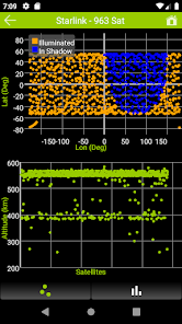
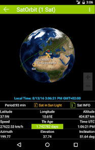
Real-time position of the International Space Station also including other 1450 satellites, online and off-line, after downloading orbit data (Tle).
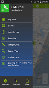
Current feature:
- Satellite tracking for visual observation
- Time machine with play, pause, stop with time step customizable
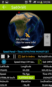
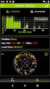
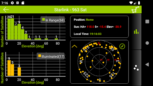
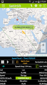
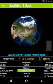
- Display of Satellite data (azimuth, elevation, latitude, longitude, altitude, speed....) also offline
- Ground Station settings with Gps, Mobile and manual settings
- There are four types of maps available (Normal, Satellite, Terrain, Hybrid)
- Satellite footprint and Solar terminator line
- Display of Sun position in real-time
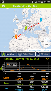
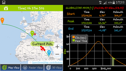
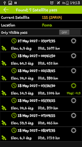
- Satellite predictions passes with step up to 24, 48, 72 hours with Map View and Compass View details.
- Satellite category view and search view feature (Special Interest, Weather & Earth Resources, Communications, Navigation, Scientific and Miscellaneous).
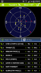
- Display of What's up in your sky over your head with Map View and Compass View details
App icons by Icons4Android.
App icons by Icons8.com.
Current feature:
- Satellite tracking for visual observation
- Time machine with play, pause, stop with time step customizable
- Display of Satellite data (azimuth, elevation, latitude, longitude, altitude, speed....) also offline
- Ground Station settings with Gps, Mobile and manual settings
- There are four types of maps available (Normal, Satellite, Terrain, Hybrid)
- Satellite footprint and Solar terminator line
- Display of Sun position in real-time
- Satellite predictions passes with step up to 24, 48, 72 hours with Map View and Compass View details.
- Satellite category view and search view feature (Special Interest, Weather & Earth Resources, Communications, Navigation, Scientific and Miscellaneous).
- Display of What's up in your sky over your head with Map View and Compass View details
App icons by Icons4Android.
App icons by Icons8.com.
Updated on
Safety starts with understanding how developers collect and share your data. Data privacy and security practices may vary based on your use, region and age The developer provided this information and may update it over time.

No data shared with third parties
Learn more about how developers declare sharing

No data collected
Learn more about how developers declare collection
Ratings and reviews
4.2
278 reviews

P.K. Danizzimo
- Flag inappropriate
10 December 2021
Enjoying the app, going for virtual spins around the earth is great fun ,, though Apps of this type work better for clarity in zoom mode with the amount of pixels your camera or device has . Would like to see zoom to approx 200 metres above ground level and below the ocean water level to see the ocean floor etc, and able to track a specific area with touch mode. A Thunderbird 58

A Google user
- Flag inappropriate
9 July 2019
I am a amateur radio operator and i have been searching for a useful satellite tracking app. This one is awesome and works great. It tells me the azimuth heading and where is crosses in the sky so i can track it. If you just want to know when to look for the ISS at night it will tell you. Great app.... keep up the good work! !!!!!!!
5 people found this review helpful
SilvioItaly
9 July 2019
I'm still working to improve SatOrbit features....glad to see it's useful for you...thanks for your feedback.
A Google user
- Flag inappropriate
18 October 2019
Great potential but several issues. You can ony choose one agency at a time to download. Other issue is you can only download tle info from the sites once every 6 hrs?? Why ???if the download didnt work correctly, the app is useless untill it will allow me to re-download. Other issue is it still says my Tle info is outdated even after i updated it. Also every sattelite it shows for my area has a magnatude so hight that none are visible. Finally why are the viewing hrs only around 1 hr.
5 people found this review helpful
SilvioItaly
19 October 2019
Thanks for your feedback . . I'll tackle some issue you pointed out...If you write me by mail I can answer some of your questions too.
What's new
Bug Fix