

Tainan Historical Maps

10K+
Downloads

Everyone
info

About this app
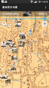
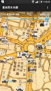
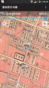
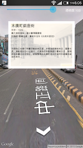
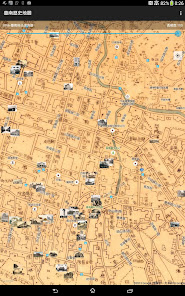
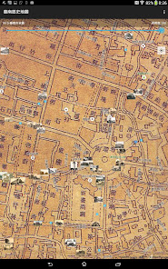
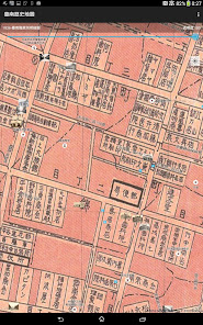
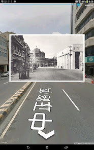
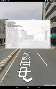
The Tainan Historical Maps gathers old maps and photos published between 1875 and 1978 and compares them to Google Maps and Street View. When a device's mobile positioning function is added in, users can compare the old and new maps and photos as they walk around, allowing them to "travel in time" and relive the elegance of old Tainan. Eleven different maps of Tainan's streets from different eras provided by the Academia Sinica Center for Geographic Information Systems (GIS) and the Research Center for Humanities and Social Sciences (RCHSS) show an area approximately within Tainan's city limits. It also contains 129 photos from the archives of the Academia Sinica Institute of Taiwan History, National Taiwan Library, and the National Taiwan University Library that include images of official buildings and street shops.
Disclaimer:
1. The maps are provided for reference purposes only; the geographic accuracy of the old maps is not guaranteed. The GIS is not responsible for any liabilities caused by the use of this app.
2. The Google Maps and Street View functions may require an Internet connection.
Disclaimer:
1. The maps are provided for reference purposes only; the geographic accuracy of the old maps is not guaranteed. The GIS is not responsible for any liabilities caused by the use of this app.
2. The Google Maps and Street View functions may require an Internet connection.
Updated on
Safety starts with understanding how developers collect and share your data. Data privacy and security practices may vary based on your use, region and age The developer provided this information and may update it over time.

No data shared with third parties
Learn more about how developers declare sharing

No data collected
Learn more about how developers declare collection
What's new
Update the target API level to 33 (Android 13).