

QH sử dụng đất Lâm Đồng
Contains ads

10K+
Downloads

Everyone
info
About this app
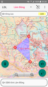
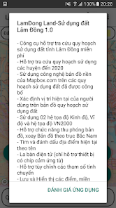
- Support look up land use planning, land use plan (final period) to 2020
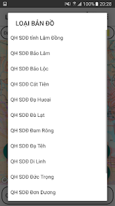
- Districts: Bao Lam, Bao Loc, Cat Tien, Da Huoai, Da Lat, Dam Rong, Da Te, Di Linh, Duc Trong, Don Duong, Lac Duong and Lam Ha.
- Using Mapbox.com's base map technology on published land use plans
- Determining the user's current location on land use planning map
- Use 02 coordinate systems Longitude, Latitude and coordinate system VN2000
- Support map zoom function, rotate the map to the North-South axis
- Find and bookmark current locations by name
- Electronic compass (supports only devices with magnetic induction chips)
- Support to customize the transfer parameters
- Save and display points, area areas according to Objects and Projects
- Change colors, hide objects and points in the Project
- Save the free drawing area
- View, Edit, Delete, Find Landmarks
- Function guide the object, save points
- Support function to redraw survey routes over time
- Support displaying map styles from mapbox.com
- Drawing Points, Polygon Domains; Measure the Distance, calculate the Area
- Export point data to .kml .gpx file types
- Support importing point data from .gpx file
- Send and exchange data of saved points
- Support tools to convert between coordinate systems
Updated on
Data safety
Developers can show information here about how their app collects and uses your data. Learn more about data safety

No information available


