
Las historii
1K+
Downloads

Everyone
info


About this app
As part of the Forest of History project. Do you know that? "On the website and in the mobile application contains information about places of national remembrance and other places worth visiting in 23 districts of the Regional Directorate of State Forests in Radom, located within the Świętokrzyskie Province and the southern part of Mazovia. In this region there is no forest inspectorate, on whose territory there would be a dozen or so dozens of objects commemorating the events witnessed by forests. Together, there are over 400 of them in the RDSF in Radom. Among them there are cemeteries, graves, monuments, crosses and other objects from the January Uprising, World Wars I and II, the post-war period, well-deserved figures, and other places important from the point of view. seeing historical events.
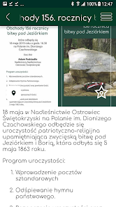
Places of memory come from different periods of time. Generally speaking, they are connected with the struggles for independence, although individual events document and other situations. e.g. Swedish wars. There are also no rules for their deployment. For example, the period of the First World War documents cemeteries located mainly in the northern part (forest districts Dobieszyn, Kozienice, Zwoleń) and southern cemeteries (Kielce and Jędrzejów Forest Districts). The period of the January Uprising is documented by obelisks and monuments placed in all districts. The same applies to the period of World War II. There are almost no commemorated places from the period of the November Uprising, as there were very few battles in this area.
The project also presents natural and cultural values of the RDSF area in Radom as well as tourism infrastructure and forest education infrastructure. We also encourage you to visit other places that are worth visiting, such as educational centers and chambers, green classes, stopping places, resting places, campsites, natural objects, cultural heritage, forest headquarters and other facilities. The application also includes educational paths, hiking trails, bicycle paths, Nordic walking routes, horse trails, cross-country skiing and other routes useful for tourists.
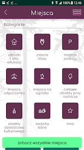
In order to make it easier to find interesting places, the base of the objects has been divided into categories, and the places of memory are additionally divided into time categories. The site and application also contain stories related to national memorial sites and related events. The full database of points and routes can be viewed on the map. From the map level you can also go to the details of the selected object. OpenStreetMap primers are available offline. The mobile guide also acts as a communicator between tourists and foresters - the user can report, for example, illegal garbage dump, fire and is informed about the most important events in the area. An interesting feature is the ability to add a place proposal for inclusion in the project and send it to the site.
Line and point objects (routes, etc.) visible on the map end at the border of the management of forest inspectorates. The application was financed from the own resources of the State Forests.
Places of memory come from different periods of time. Generally speaking, they are connected with the struggles for independence, although individual events document and other situations. e.g. Swedish wars. There are also no rules for their deployment. For example, the period of the First World War documents cemeteries located mainly in the northern part (forest districts Dobieszyn, Kozienice, Zwoleń) and southern cemeteries (Kielce and Jędrzejów Forest Districts). The period of the January Uprising is documented by obelisks and monuments placed in all districts. The same applies to the period of World War II. There are almost no commemorated places from the period of the November Uprising, as there were very few battles in this area.
The project also presents natural and cultural values of the RDSF area in Radom as well as tourism infrastructure and forest education infrastructure. We also encourage you to visit other places that are worth visiting, such as educational centers and chambers, green classes, stopping places, resting places, campsites, natural objects, cultural heritage, forest headquarters and other facilities. The application also includes educational paths, hiking trails, bicycle paths, Nordic walking routes, horse trails, cross-country skiing and other routes useful for tourists.
In order to make it easier to find interesting places, the base of the objects has been divided into categories, and the places of memory are additionally divided into time categories. The site and application also contain stories related to national memorial sites and related events. The full database of points and routes can be viewed on the map. From the map level you can also go to the details of the selected object. OpenStreetMap primers are available offline. The mobile guide also acts as a communicator between tourists and foresters - the user can report, for example, illegal garbage dump, fire and is informed about the most important events in the area. An interesting feature is the ability to add a place proposal for inclusion in the project and send it to the site.
Line and point objects (routes, etc.) visible on the map end at the border of the management of forest inspectorates. The application was financed from the own resources of the State Forests.
Updated on
Safety starts with understanding how developers collect and share your data. Data privacy and security practices may vary based on your use, region and age The developer provided this information and may update it over time.

No data shared with third parties
Learn more about how developers declare sharing

No data collected
Learn more about how developers declare collection

Data isn’t encrypted
Data can’t be deleted


