

Military MGRS Navi V2

3.6star
32 reviews
1K+
Downloads

Everyone
info
About this app
Changes map of Military MGRS Navi to google map v2. And add functionality.
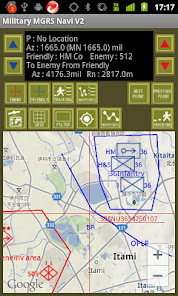
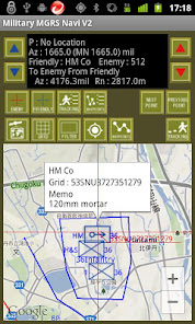
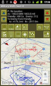
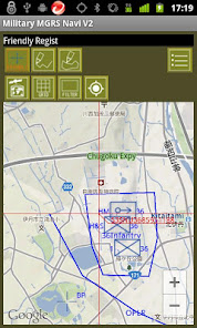
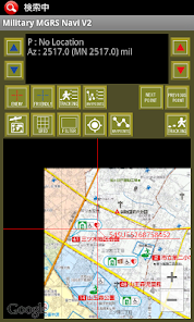
It is a navigation tool that specializes in MGRS coordinate that is used by the U.S. military.
Azimuth is displayed mil.
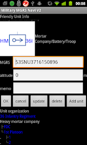
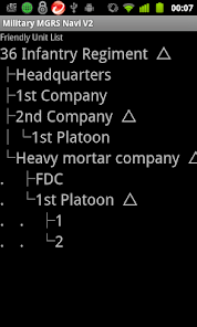
You can plot the position of friend and enemy.
Draw operation line and area.
Unit symbol can be move position. by drag.
The symbols are the standard U.S. Army title.
Own map function
This can be used as a map to its own image.
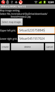
In Map Image Setting the menu on the main screen, you can create a data by entering the coordinates of the upper left and lower right of the image and the image you want to use the map, so that it can be used in the map image at the beginning.
Data generated will be stored in MilitaryMgrsNaviV2 folder of the SD card.
Data that is created, is dependent by memory and SD card capacity. I think better to create frequently a small range images and smaller is better. Data that you create will be added to data that is until now.
Please note that all data up to now will be deleted if you delete.
The image you want to use, please create based on the true north rather than the grid north.
Please change the type you do not want to display a map of the normal map type to be displayed in map its own image. It can not be displayed simultaneously with the normal map.
It is a navigation tool that specializes in MGRS coordinate that is used by the U.S. military.
Azimuth is displayed mil.
You can plot the position of friend and enemy.
Draw operation line and area.
Unit symbol can be move position. by drag.
The symbols are the standard U.S. Army title.
Own map function
This can be used as a map to its own image.
In Map Image Setting the menu on the main screen, you can create a data by entering the coordinates of the upper left and lower right of the image and the image you want to use the map, so that it can be used in the map image at the beginning.
Data generated will be stored in MilitaryMgrsNaviV2 folder of the SD card.
Data that is created, is dependent by memory and SD card capacity. I think better to create frequently a small range images and smaller is better. Data that you create will be added to data that is until now.
Please note that all data up to now will be deleted if you delete.
The image you want to use, please create based on the true north rather than the grid north.
Please change the type you do not want to display a map of the normal map type to be displayed in map its own image. It can not be displayed simultaneously with the normal map.
Updated on
Safety starts with understanding how developers collect and share your data. Data privacy and security practices may vary based on your use, region and age The developer provided this information and may update it over time.

No data shared with third parties
Learn more about how developers declare sharing

No data collected
Learn more about how developers declare collection
Ratings and reviews
3.6
30 reviews

A Google user
- Flag inappropriate
16 May 2019
I would give 5 stars if I could create more than 2 way points and also input way points manually.
1 person found this review helpful
A Google user
- Flag inappropriate
- Show review history
27 October 2018
It's a good tools for military personnel.
3 people found this review helpful
A Google user
- Flag inappropriate
- Show review history
4 August 2018
Can only enter a-b waypoint. I cant add more. Also there's no manual or
tutorial. Its confusing trying to figure out
2 people found this review helpful
What's new
ver.1.50 Own map feature added.
ver.1.54 Add menu for android version over 4.0
ver.1.60 Specification was changed.
ver.1.70 The unit enabled it to have a class.
I added the equipment icon.
ver.1.72 Fixed reported bug.
ver.1.80 I have some changes to coordinate display on the main screen.
ver.1.81 Fixed bug.
ver.1.90 Can you data saved.
We removed the tracking function.
ver.1.91 Support for authority confirmation.
ver.1.93 Changed the coordinate input form.


