
Brújula INEGI
10K+
Downloads

Everyone
info

About this app
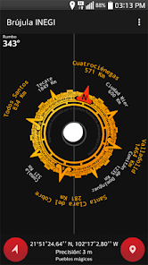
The National Institute of Statistics and Geography offers mobile application free distribution "Compass INEGI" which provides information about the orientation relative to magnetic north, obtains the location coordinates on the cardinal points shows the reference of certain cities in Mexico, as well has an option to record tracks and send the resulting file for later analysis software Geographic Information Systems (GIS) and use it, for example, for field work, logistics in transport, to track operatives field involving the movement of people, goods and services.
Main features:
- indicates the magnetic north
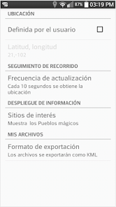
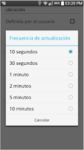
- Get the coordinates of your location using GPS, network or even mobile phone with Wi-Fi hotspots nearby
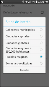
- On the cardinal displays the name of some cities in Mexico and the linear distance from the location
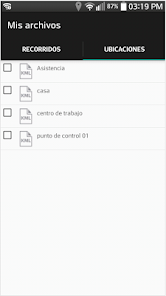
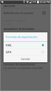
- You can record your path as you walk or drive transitas
- easy to share files tours
Warning:
Before using the compass INEGI in any activity that depends on the correct location of magnetic north (camping, ecotourism, etc.) Verify that this location on your device is correct taking into account any known reference.
Notes:
In some devices the magnetic sensor tends to lock, to correct this situation must move the device in the form of "8".
The compass accuracy depends on the sensor device and interference from magnetic fields generated by electronic equipment.
The accuracy of location coordinates sensors depends on the location of the device.
Main features:
- indicates the magnetic north
- Get the coordinates of your location using GPS, network or even mobile phone with Wi-Fi hotspots nearby
- On the cardinal displays the name of some cities in Mexico and the linear distance from the location
- You can record your path as you walk or drive transitas
- easy to share files tours
Warning:
Before using the compass INEGI in any activity that depends on the correct location of magnetic north (camping, ecotourism, etc.) Verify that this location on your device is correct taking into account any known reference.
Notes:
In some devices the magnetic sensor tends to lock, to correct this situation must move the device in the form of "8".
The compass accuracy depends on the sensor device and interference from magnetic fields generated by electronic equipment.
The accuracy of location coordinates sensors depends on the location of the device.
Updated on
Safety starts with understanding how developers collect and share your data. Data privacy and security practices may vary based on your use, region and age The developer provided this information and may update it over time.

No data shared with third parties
Learn more about how developers declare sharing

No data collected
Learn more about how developers declare collection


