
Paris Auto Info
1K+
Downloads

Everyone
info

About this app
Paris Auto Info provides information for people using their car in Paris
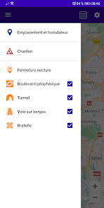
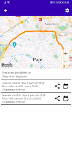
You can get information about scheduled nighttime closures:
* from device
* tunnels
* access ramps to highways
* see on banks.
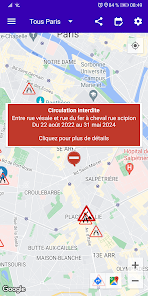
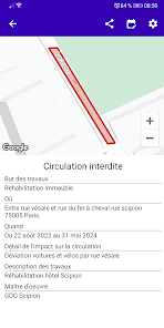
But also on the Parisian construction sites (location, description, duration and disturbances generated).
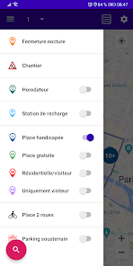
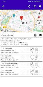
It allows you to obtain the location and characteristics of:
* Free spaces for cars
* Places for people with reduced mobility
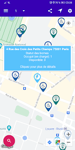
* Charging stations for electric vehicles (car and motorbike, plug type, power, availability)
* Places for all types of 2 wheels (Motorcycle/Scooter, Bicycle, Scooter)
* Places for residential parking
* Spaces for non-residential parking (visitor)
* Underground car parks (Price, number of places, maximum height,...)
* parking meters (means of payment accepted, tariffs, residential area, PMR or not, etc.).
You can search by:
* relative to your location
* the name of a street, boulevard, square,...
* residential area
* borough
* report to a selected area on the map (press for 2 seconds)
The data comes from the Paris City Hall website
https://opendata.paris.fr/pages/home/
If you wish to know the data collected by this application, you can consult the following page: https://www.viguer.net/ParisStationnementPrivacy.html
You can get information about scheduled nighttime closures:
* from device
* tunnels
* access ramps to highways
* see on banks.
But also on the Parisian construction sites (location, description, duration and disturbances generated).
It allows you to obtain the location and characteristics of:
* Free spaces for cars
* Places for people with reduced mobility
* Charging stations for electric vehicles (car and motorbike, plug type, power, availability)
* Places for all types of 2 wheels (Motorcycle/Scooter, Bicycle, Scooter)
* Places for residential parking
* Spaces for non-residential parking (visitor)
* Underground car parks (Price, number of places, maximum height,...)
* parking meters (means of payment accepted, tariffs, residential area, PMR or not, etc.).
You can search by:
* relative to your location
* the name of a street, boulevard, square,...
* residential area
* borough
* report to a selected area on the map (press for 2 seconds)
The data comes from the Paris City Hall website
https://opendata.paris.fr/pages/home/
If you wish to know the data collected by this application, you can consult the following page: https://www.viguer.net/ParisStationnementPrivacy.html
Updated on
Safety starts with understanding how developers collect and share your data. Data privacy and security practices may vary based on your use, region and age The developer provided this information and may update it over time.

This app may share these data types with third parties
Location

No data collected
Learn more about how developers declare collection

Data isn’t encrypted
Data can’t be deleted
What's new
Ajout des chantiers
Changement de nom de l'application : "Paris Stationnement" devient "Paris Auto Info"
Changement de nom de l'application : "Paris Stationnement" devient "Paris Auto Info"