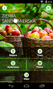
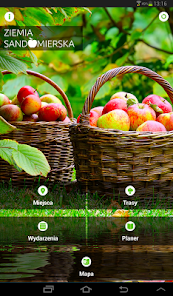
Ziemia Sandomierska
1K+
Downloads

Everyone
info


About this app
"Earth Sandomierska" is a mobile application at very attractive region stretching north and west of Sandomierz. Although these areas irrevocably associated with extensive orchards, juicy apples, as well as many other kinds of fruit (eg. Apricots, plums, and cherries) and vegetables (eg. Tomatoes, cauliflower, carrots or time), in addition unusual flavors also offer unusual tourist attractions.
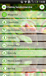
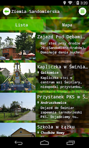
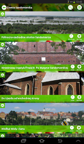
The application area includes the following municipalities: Dwikozy, Klimontow, Koprzywnica, Lipnik, Łoniów, Images, Samborzec, Wilczyce and Zawichost. With mobile guide, we explore the most interesting corners of the land - both monuments and attractive in terms of natural objects, including those of a sports and recreation center. Every tourist visiting the region will find here some original recommendation of culinary and accommodation, as well as other practical information that will help in exploring these areas.
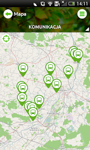
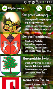
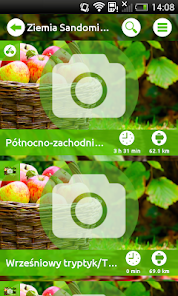
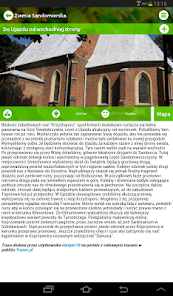
An additional advantage of the application are hiking trails around the region developed by users of social networking Traseo.pl, as well as the most important events in the area above. municipalities. The application uses GPS technology, showing the position of the user and locations of objects. It works both online and offline.
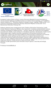
The application was developed by Amistad Group, based on the original technology Treespot project Fri. "Earth Sandomierska- mobile tourist information system." The application is co-financed by the European Union, Axis IV LEADER under Measure 413 "Implementing local development strategies" under the RDP 2007-2013. Managing Authority of the Rural Development Program for 2007-2013. The Ministry of Agriculture and Rural Development. European Agricultural Fund for Rural Development: Europe investing in rural areas.
The application area includes the following municipalities: Dwikozy, Klimontow, Koprzywnica, Lipnik, Łoniów, Images, Samborzec, Wilczyce and Zawichost. With mobile guide, we explore the most interesting corners of the land - both monuments and attractive in terms of natural objects, including those of a sports and recreation center. Every tourist visiting the region will find here some original recommendation of culinary and accommodation, as well as other practical information that will help in exploring these areas.
An additional advantage of the application are hiking trails around the region developed by users of social networking Traseo.pl, as well as the most important events in the area above. municipalities. The application uses GPS technology, showing the position of the user and locations of objects. It works both online and offline.
The application was developed by Amistad Group, based on the original technology Treespot project Fri. "Earth Sandomierska- mobile tourist information system." The application is co-financed by the European Union, Axis IV LEADER under Measure 413 "Implementing local development strategies" under the RDP 2007-2013. Managing Authority of the Rural Development Program for 2007-2013. The Ministry of Agriculture and Rural Development. European Agricultural Fund for Rural Development: Europe investing in rural areas.
Updated on
Safety starts with understanding how developers collect and share your data. Data privacy and security practices may vary based on your use, region and age The developer provided this information and may update it over time.

No data shared with third parties
Learn more about how developers declare sharing

No data collected
Learn more about how developers declare collection

Data isn’t encrypted
Data can’t be deleted


