
Clearion
500+
ការទាញយក

គ្រប់គ្នា
info


អំពីកម្មវិធីនេះ
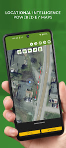
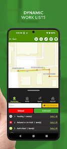
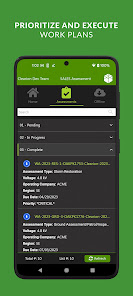
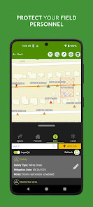
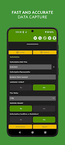
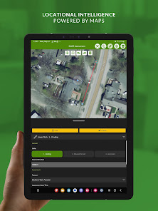
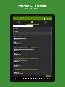
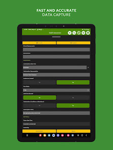
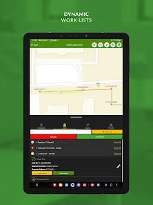
Clearion is a location-based project and program management solution for construction and maintenance operations. Connect everyone from the office to the field and across large stakeholder groups to work smarter, safer, and faster.
Learn more at clearion.com or reach out at support@clearion.com with questions.
Learn more at clearion.com or reach out at support@clearion.com with questions.
បានដំឡើងកំណែនៅ
សុវត្ថិភាពចាប់ផ្ដើមពីការយល់ដឹងអំពីរបៀបដែលអ្នកអភិវឌ្ឍន៍ប្រមូល និងចែករំលែកទិន្នន័យរបស់អ្នក។ ការអនុវត្តចំពោះសុវត្ថិភាព និងឯកជនភាពទិន្នន័យអាចខុសគ្នាទៅតាមការប្រើប្រាស់ តំបន់ និងអាយុរបស់អ្នក។ អ្នកអភិវឌ្ឍន៍បានផ្ដល់ព័ត៌មាននេះ និងអាចធ្វើបច្ចុប្បន្នភាពវានៅពេលខាងមុខ។

មិនចែករំលែកទិន្នន័យជាមួយភាគីទីបីឡើយ
ស្វែងយល់បន្ថែមអំពីរបៀបដែលអ្នកអភិវឌ្ឍន៍ប្រកាសអំពីការចែករំលែកទិន្នន័យ

កម្មវិធីនេះអាចប្រមូលប្រភេទទិន្នន័យទាំងនេះ
ទីតាំង

ទិន្នន័យត្រូវបានអ៊ីនគ្រីបសម្រាប់ការផ្ទេរ

មិនអាចលុបទិន្នន័យបានទេ
អ្វីដែលថ្មី
• Geofencing: send location-based push notifications or trigger data automations
• Navigation: build multi-stop routes, and then engage turn-by-turn navigation
• Required Fields: ensure high quality field data by forcing users to fill out all necessary fields
• Sorting: organize lists and dropdowns by what matters most to find work faster
• Real time data: automatically pull in new data when working online
• Long term support: ArcGIS Maps SDK supported until 2027
• Revamped offline mode (beta)