US Army Map Symbols
ବିଜ୍ଞାପନ ଅନ୍ତର୍ଭୂକ୍ତ
4.0star
19ଟି ସମୀକ୍ଷା
5ହ+
ଡାଉନଲୋଡଗୁଡ଼ିକ

ସମସ୍ତେ
info
ଏହି ଆପ୍ ବିଷୟରେ
Application describes topographic symbols used for interpretation of US military maps.
Symbols given in this application are in general agreement with those employed by the British Army, the Canadian Army, the Aeronautical Chart and Information Service of the US Air Force, the Hydrographic Office of the US Navy, the US Coast and Geodetic Survey, the US Forest Service, the US Geological Servey and others.
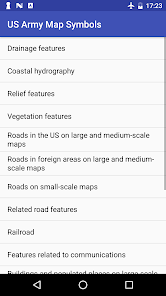
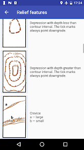
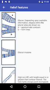
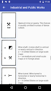
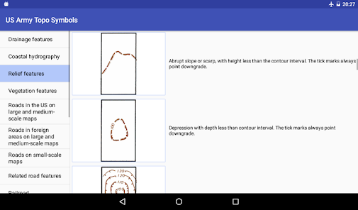
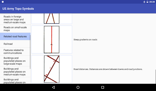
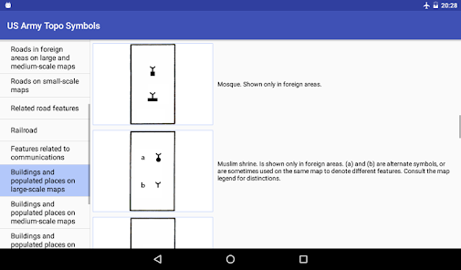
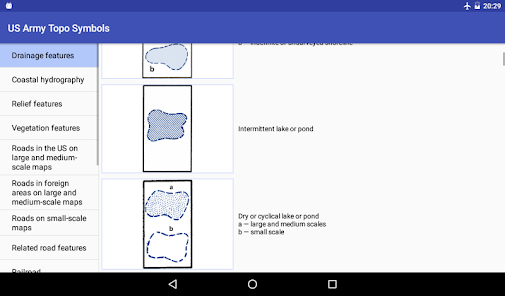
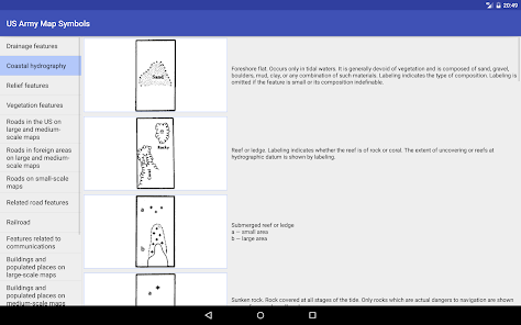
Topographic symbols are arranged by categories, such as drainage features, relief, roads etc.
Symbols given in this application are in general agreement with those employed by the British Army, the Canadian Army, the Aeronautical Chart and Information Service of the US Air Force, the Hydrographic Office of the US Navy, the US Coast and Geodetic Survey, the US Forest Service, the US Geological Servey and others.
Topographic symbols are arranged by categories, such as drainage features, relief, roads etc.
ଗତ ଅପଡେଟର ସମୟ
ଡେଭେଲପରମାନେ ଆପଣଙ୍କ ଡାଟାକୁ କିପରି ସଂଗ୍ରହ ଏବଂ ସେୟାର କରନ୍ତି ସେହି ଧାରଣା ସହିତ ସୁରକ୍ଷା ଆରମ୍ଭ ହୁଏ। ଆପଣଙ୍କ ବ୍ୟବହାର, ଅଞ୍ଚଳ ଏବଂ ବୟସ ଆଧାରରେ, ଡାଟା ଗୋପନୀୟତା ଓ ସୁରକ୍ଷା କାର୍ଯ୍ୟପଦ୍ଧତିଗୁଡ଼ିକ ଭିନ୍ନ ହୋଇପାରେ। ଡେଭେଲପର ଏହି ସୂଚନା ପ୍ରଦାନ କରିଛନ୍ତି ଏବଂ ସେ ସମୟାନୁସାରେ ଏହାକୁ ଅପଡେଟ କରିପାରନ୍ତି।

ତୃତୀୟ ପକ୍ଷଗୁଡ଼ିକ ସହ କୌଣସି ଡାଟା ସେୟାର କରାଯାଇନାହିଁ
ଡେଭେଲପରମାନେ କିପରି ସେୟାରିଂର ଘୋଷଣା କରନ୍ତି ସେ ବିଷୟରେ ଅଧିକ ଜାଣନ୍ତୁ

କୌଣସି ଡାଟା ସଂଗ୍ରହ କରାଯାଇନାହିଁ
ଡେଭେଲପରମାନେ କିପରି ସଂଗ୍ରହର ଘୋଷଣା କରନ୍ତି ସେ ବିଷୟରେ ଅଧିକ ଜାଣନ୍ତୁ
ମୂଲ୍ୟାଙ୍କନ ଓ ସମୀକ୍ଷା
4.0
16ଟି ସମୀକ୍ଷା


