
かわさき防災アプリ
10K+
Downloads

Everyone
info


About this app
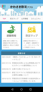
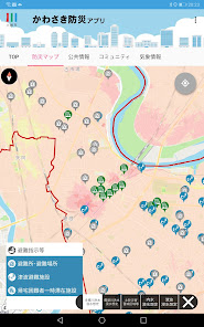
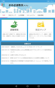
With the Kawasaki Disaster Prevention App, you can check a hazard map that shows dangerous areas such as floods, landslides, tsunamis, and inland waters on a map, as well as evacuation information that is being issued, evacuation center opening information, and evacuation center congestion status. or list in real time.
[Provided information and main functions]
・In addition to Japanese, it supports simplified Chinese, traditional Chinese, English, and Korean.
・When emergency information occurs, you will be notified by push notification
・Equipped with various hazard maps and disaster prevention maps (partially compatible with offline)
・ Real-time notification of evacuation information such as evacuation of the elderly, evacuation orders, and emergency safety assurance
・Check the map for evacuation information that is being issued and evacuation center opening (congestion degree) information
・Freely create a community and share information with family and friends
Updated on
Safety starts with understanding how developers collect and share your data. Data privacy and security practices may vary based on your use, region, and age. The developer provided this information and may update it over time.

No data shared with third parties
Learn more about how developers declare sharing

No data collected
Learn more about how developers declare collection

Committed to follow the Play Families Policy
What's new
・避難所混雑状況の地図表示に対応しました
・軽微な不具合を修正しました
・軽微な不具合を修正しました
App support
phone
Phone number
+81442002857