
Land Size
Reklamalar mavjud
100+
Yuklanmalar

3+
info
Bu ilova haqida
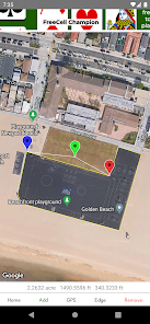
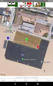
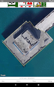
Measure land areas, residential lots, acreages and other real estate properties by drawing or walking the boundary of a property or any land area on the map.
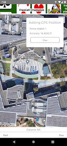
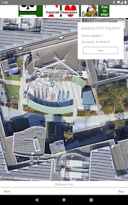
Points can be captured by tapping on the map, adding the center point of the map, or traversing the perimeter of an area and capturing GPS positions.
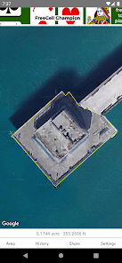
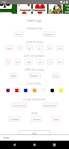
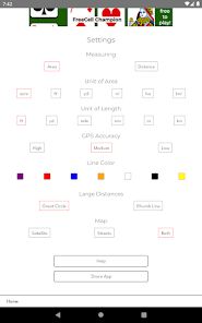
Areas are calculated in several units of measurement, including acres, square feet, square meters, and hectares.
Area perimeters and distances are calculated in feet, meters and yards.
Measure distances by drawing lines or capturing GPS positions while moving.
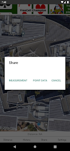
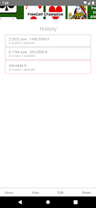
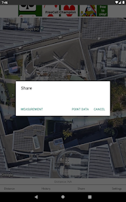
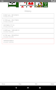
Measurements are saved in the history screen and can be recalled for viewing, editing and sharing.
Large distances are accurately represented as great-circle lines. (Straight lines on globes that appear as curved lines on flat maps.)
Measuring land areas using this app does not replace the need for land surveying.
Points can be captured by tapping on the map, adding the center point of the map, or traversing the perimeter of an area and capturing GPS positions.
Areas are calculated in several units of measurement, including acres, square feet, square meters, and hectares.
Area perimeters and distances are calculated in feet, meters and yards.
Measure distances by drawing lines or capturing GPS positions while moving.
Measurements are saved in the history screen and can be recalled for viewing, editing and sharing.
Large distances are accurately represented as great-circle lines. (Straight lines on globes that appear as curved lines on flat maps.)
Measuring land areas using this app does not replace the need for land surveying.
Oxirgi yangilanish
Xavfsizlik — dastur ishlab chiquvchilar maʼlumotlaringizni qanday jamlashi va ulashishini tushinishdan boshlanadi. Maʼlumotlar maxfiyligi va xavfsizlik amaliyotlari ilovadan foydalanish, hudud va yoshga qarab farq qilishi mumkin. Bu axborot dastur ishlab chiquvchi tomonidan taqdim etilgan va keyinchalik yangilanishi mumkin.


Nima yangiliklar
General bug fixes and improvements.


