
GIS Survey Mobile
100 hilj.+
Preuzimanja

Svako
info


O aplikaciji
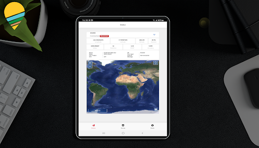
GIS Survey Mobile is an application designed to make it easier for surveyors to perform more efficient topography measurements.
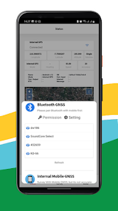
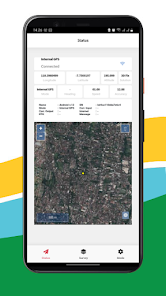
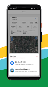
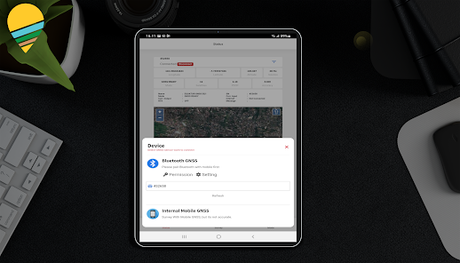
GIS Survey Mobile is intended for retrieving Geodetic GNSS Coordinate data from the Equator GNSS Product (recommendation), but if you don't have an Equator GNSS Unit, you can also use it from the Smartphone Internal GPS integration, but the accuracy is not as good as using the Equator Geodetic GNSS.
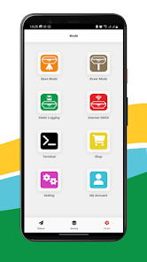
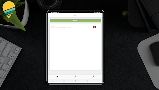
With GIS Survey Mobile, surveyors can determine project activities through simpler command features such as those used for Static measurements, RTK Radio, NTRIP, PPK Mode, and from GIS Survey Mobile later output data in the form of points, lines and areas.
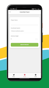
Exporting results from data retrieval using GIS Survey Mobile is easier and more convenient, with the stored data having a choice of the required data formats such as .TXT .CSV .GEOJSON. Apart from that, it is also supported by importing Geojson data which can be used for reference points or work areas that have been planned.
Simple application usage
Free download from Google Play Store.
compatible with android devices.
Support all survey modes, including Static, PPK, RTK dan NTRIP.
Support to serve various survey tasks. seperti Surface Stake, Mapping Survey and etc.
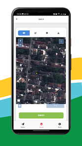
Access to real-time open street maps.
Support Geojson import and directly use for stake out operations.
GIS Survey Mobile is intended for retrieving Geodetic GNSS Coordinate data from the Equator GNSS Product (recommendation), but if you don't have an Equator GNSS Unit, you can also use it from the Smartphone Internal GPS integration, but the accuracy is not as good as using the Equator Geodetic GNSS.
With GIS Survey Mobile, surveyors can determine project activities through simpler command features such as those used for Static measurements, RTK Radio, NTRIP, PPK Mode, and from GIS Survey Mobile later output data in the form of points, lines and areas.
Exporting results from data retrieval using GIS Survey Mobile is easier and more convenient, with the stored data having a choice of the required data formats such as .TXT .CSV .GEOJSON. Apart from that, it is also supported by importing Geojson data which can be used for reference points or work areas that have been planned.
Simple application usage
Free download from Google Play Store.
compatible with android devices.
Support all survey modes, including Static, PPK, RTK dan NTRIP.
Support to serve various survey tasks. seperti Surface Stake, Mapping Survey and etc.
Access to real-time open street maps.
Support Geojson import and directly use for stake out operations.
Ažurirano dana
Sigurnost počinje razumijevanjem na koji način programeri prikupljaju i dijele vaše podatke. Privatnost podataka i sigurnosne prakse se mogu razlikovati ovisno o korištenju, regiji i dobi. Programer je naveo ove informacije i može ih s vremenom ažurirati.

Podaci se ne dijele s trećim stranama
Saznajte više o načinu na koji programeri pružaju izjavu o dijeljenju

Podaci se ne prikupljaju
Saznajte više o načinu na koji programeri pružaju izjavu o prikupljanju
Što je novo
Fix Major Bug
Podrška za aplikaciju
Informacije o programeru
PT. TECHNO GIS INDONESIA
info@technogis.co.id
Jl. Pamularsih No. 152B, Ngabean Wetan
Sinduharjo, Ngaglik
Kabupaten Sleman
Daerah Istimewa Yogyakarta 55581
Indonesia
+62 813-2552-3979


