LiDAR VR Viewer
Kupovina unutar aplikacije
3,7star
1,12 hilj. recenzija
50 hilj.+
Preuzimanja

Svako
info
O aplikaciji
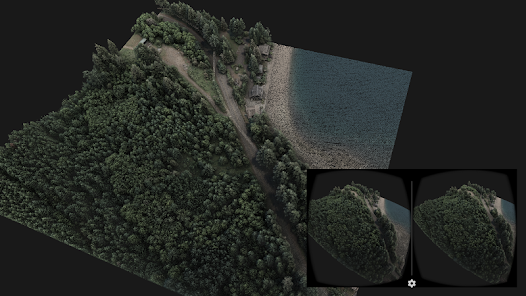
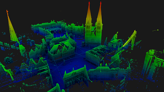
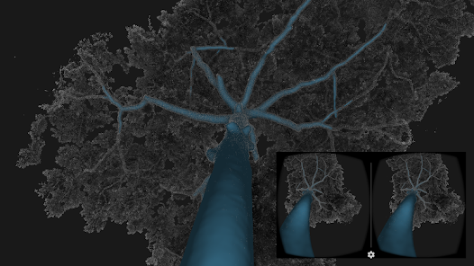
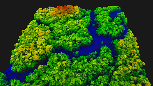
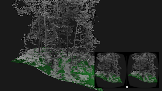
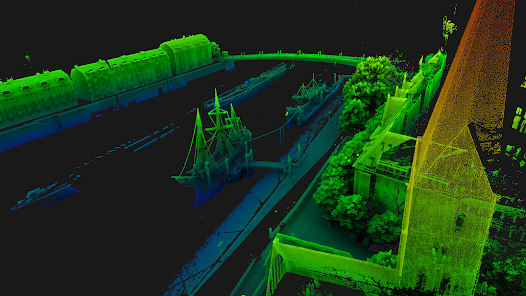
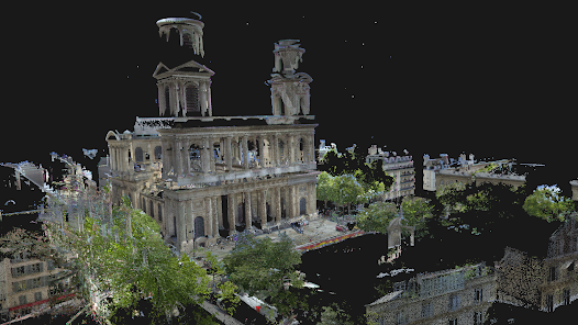
LiDAR VR Viewer is dedicated to the visualization of point clouds and surfaces as an immersive experience through virtual reality. With a Bluetooth controller and a simple head-mounted display such as Google cardboard, it turns into a powerful tool to investigate and explore 3D data.
A scientific paper describing this app has been published in the proceedings of the 11th International Conference on Computer Graphics, Visualization, Computer Vision and Image Processing (2017)
Features :
• Developed for virtual reality head mounted displays such has Google Cardboard
• All-native rendering utilizing OpenGL ES 2.0
• Supports point cloud ASCII files
• Colors the points from elevation, intensity or RGB values
• Supports point cloud with normals, rendered as surfel (work in progress)
• Supports point clouds up to few millions points (depends on the smartphone GPU)
• Supports surface mesh Wavefront .obj files
• Control camera movement with Blue-tooth controller or touchscreen
• * New * Demo files download-able from the start screen
• * New * Button mapping of blue-tooth controller detailed in the start screen menu
• * New * Casting mode to broadcast the 3D model on TV (requires a controller)
Note :
The currently supported input ASCII files are as follows, without header (The columns must be separated by space character : " ")
• 3 columns X Y Z :
1.234 2.567 3.891
• 4 columns X Y Z intensity (float) :
1.234 2.567 3.891 0.2
• 6 columns X Y Z R G B [0-255] :
1.234 2.567 3.891 125 250 135
• 6 columns X Y Z Nx Ny Nz (coordinates + normals):
1.234 2.567 3.891 0.11 0.07 0.91
Ažurirano dana
Sigurnost počinje razumijevanjem na koji način programeri prikupljaju i dijele vaše podatke. Privatnost podataka i sigurnosne prakse se mogu razlikovati ovisno o korištenju, regiji i dobi. Programer je pružio ove informacije i može ih s vremenom ažurirati.

Podaci se ne dijele s trećim stranama
Saznajte više o načinu na koji programeri pružaju izjavu o dijeljenju

Podaci se ne prikupljaju
Saznajte više o načinu na koji programeri pružaju izjavu o prikupljanju
Ocjene i recenzije
3,7
1,1 hilj. recenzije

Googleov korisnik
- Označavanje kao neprikladno
29. septembar 2019.
super
Šta ima novo
Cel shading is now combined with SSAO for a better visual result
Previous version:
- Bug fix: openGL depth got buggy in the last version
- Experimental feature: cel shading to enhance the point clouds visualization
- Screen touch control now available again
- Added one extra demo dataset: 4 millions points forest LiDAR scan
Previous version:
- Bug fix: openGL depth got buggy in the last version
- Experimental feature: cel shading to enhance the point clouds visualization
- Screen touch control now available again
- Added one extra demo dataset: 4 millions points forest LiDAR scan