National Airspace System Stat
4.7star
11 reviews
500+
Downloads

Everyone
info
About this app
NATIONAL AIRSPACE SYSTEM STATUS (NASS)
NASS is a collection of links and resources providing real-time status of the US National Airspace System. Information and links are derived from the AIR TRAFFIC CONTROL SYSTEM COMMAND CENTER (ATCSCC) web page as well as other government aviation entities.
Intended primarily for Aviation Professionals, it is a quick reference tool for Traffic Management Coordinators, Specialists and Managers as well as Airline ATC Coordinators, Dispatchers, and Flight Crews. Professional Pilots may find it useful for planning purposes as well for determining causes of delays or potential delays due to routing, weather, or other events affecting the NAS.
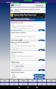
Frequent travelers may find it useful in determining why their flight may be delayed. Check out the "REF" button to become familiarized with some of the terminology as well as explanations of why Traffic Management Initiatives are used.
** NOTE ** All information is freely available from public government sources. This app only aggregates what the developer considers convenient and useful access to this information in the business and professional aviation environments and is in no way represents nor is associated with any federal or other government organizations. Further information is available from: www.intellicast.com, aviationweather.gov, fly.faa.gov, and faa.gov.
BUTTONS
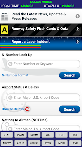
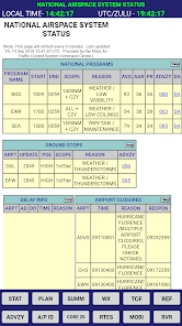
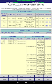
STAT - National Airspace System Status
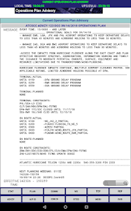
PLAN - Current Operations Plan Advisory (updated every 2 hours from the ATCSCC National TELCON)
SUMM - National Airport Status Summary (mobile format)
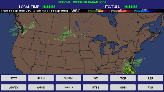
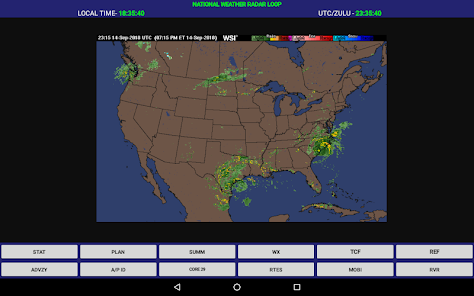
WX - Current National Weather RADAR Snapshot (Animated in PAID Ver.)
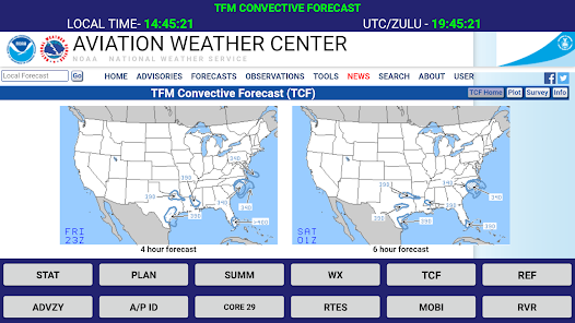
TCF - 4, 6,and 8 Hour TFM Convective Forecast
REF - Air Traffic Management Reference
ADVZY - The Most Recent ATCSCC Advisory
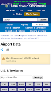
A/P ID - Airport Identifier Lookup
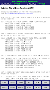
CORE 29 - Aviation Weather TAF & METAR for the Core 29 US Airports
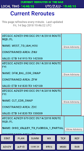
RTES - Current Reroutes in the NAS
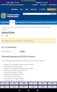
MOBI - FAA Mobile Link
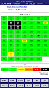
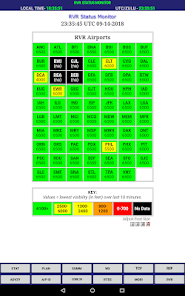
RVR - Runway Visual Range Chart
NASS is a collection of links and resources providing real-time status of the US National Airspace System. Information and links are derived from the AIR TRAFFIC CONTROL SYSTEM COMMAND CENTER (ATCSCC) web page as well as other government aviation entities.
Intended primarily for Aviation Professionals, it is a quick reference tool for Traffic Management Coordinators, Specialists and Managers as well as Airline ATC Coordinators, Dispatchers, and Flight Crews. Professional Pilots may find it useful for planning purposes as well for determining causes of delays or potential delays due to routing, weather, or other events affecting the NAS.
Frequent travelers may find it useful in determining why their flight may be delayed. Check out the "REF" button to become familiarized with some of the terminology as well as explanations of why Traffic Management Initiatives are used.
** NOTE ** All information is freely available from public government sources. This app only aggregates what the developer considers convenient and useful access to this information in the business and professional aviation environments and is in no way represents nor is associated with any federal or other government organizations. Further information is available from: www.intellicast.com, aviationweather.gov, fly.faa.gov, and faa.gov.
BUTTONS
STAT - National Airspace System Status
PLAN - Current Operations Plan Advisory (updated every 2 hours from the ATCSCC National TELCON)
SUMM - National Airport Status Summary (mobile format)
WX - Current National Weather RADAR Snapshot (Animated in PAID Ver.)
TCF - 4, 6,and 8 Hour TFM Convective Forecast
REF - Air Traffic Management Reference
ADVZY - The Most Recent ATCSCC Advisory
A/P ID - Airport Identifier Lookup
CORE 29 - Aviation Weather TAF & METAR for the Core 29 US Airports
RTES - Current Reroutes in the NAS
MOBI - FAA Mobile Link
RVR - Runway Visual Range Chart
Updated on
Safety starts with understanding how developers collect and share your data. Data privacy and security practices may vary based on your use, region, and age. The developer provided this information and may update it over time.

No data shared with third parties
Learn more about how developers declare sharing

No data collected
Learn more about how developers declare collection
Ratings and reviews
4.7
10 reviews

A Google user
- Flag inappropriate
May 12, 2019
love the app use it all this time on the job as a commercial pilot. the only thing i would like to see added is a tab for the FAA EDCT page. as a regional pilot flying in and out of NYC this would be so useful it's the only thing i have to open my browser for and it would be one less step if this was in the app. and it could maybe replace a/p id or RVR which i can get in the metar.
2 people found this review helpful
desertbreezeapps
May 14, 2019
Thank you for your feedback Steven. That may well be something I can work in for the next update.

Vincent R (Flagada002)
- Flag inappropriate
December 8, 2022
Behind a pay wa... fence... call it a fence. Only bad thing is no trial to see if it's any good. It is though. Pay the fee my fellow pilots, enjoy.
2 people found this review helpful

Matt M
- Flag inappropriate
September 9, 2023
works well, but occasionally weather radar doesn't update for extended periods of time.
What's new
The Aviation Weather Center api changed. Core 29 Metar/TAF link now works again. Thanks Dave for the heads up.