
10+
Downloads

Everyone
info
About this app
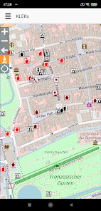
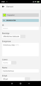
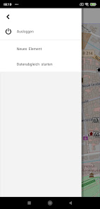
With "KLEKs - KulturLandschaftsElementeKataster" the first geoinformation system in Germany was developed with which historical cultural landscape elements can be digitally recorded according to a holistic methodology. Since 1999, over a quarter of a million records have been collected. KLEKs is not an official database, but sees itself as part of a platform for civic commitment to the preservation of livable, diverse natural and cultural landscapes - thus as a means of greater democratization of nature conservation and landscape planning. KLEKs can be applied locally by interested parties. This in no way calls into question the purpose of existing official databases for nature and monument protection. On the contrary, suitable information from KLEKs (e.g. on landscape elements that have not previously been considered but are worthy of preservation) should also be included in the official databases.
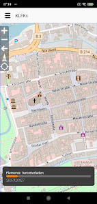
KLEKs is not an isolated solution, it can be characterized in particular by the terms community principle and self-organization as well as citizen proximity, openness and transparency. Access to a common, constantly growing and improved database is made possible by using the synergy potential of local initiatives and information that has often been scattered up to now. With this community approach, we want to tackle a comprehensive and complete recording of historical cultural landscape elements. Of course, the cadastre will never be complete and must be constantly updated.
The recording of the elements has been supplemented for several years by a recording of so-called cultural landscape parts and cells, i.e. sub-areas of the cultural landscape. We understand this as a preliminary stage of a building block for a comprehensive cultural landscape planning in the sense of the European Landscape Convention of 2000 - this is an international agreement for the preservation of landscapes worth living in for humans. Although the convention has not yet been signed by the Federal Republic of Germany, it has found general recognition in almost all other European countries.
Updated on
Safety starts with understanding how developers collect and share your data. Data privacy and security practices may vary based on your use, region, and age. The developer provided this information and may update it over time.

No data shared with third parties
Learn more about how developers declare sharing

This app may collect these data types
Personal info

Data is encrypted in transit

Data can’t be deleted
What's new
- Größeres Kartenfenster
- Vorab-Version des Geometrie-Editors
- Es gibt noch ein bekanntes Problem, wenn der Geometrie-Typ (Punkt, Linie, Polygon) eines Elements geändert und gespeichert wird (ggf. muss die App dann zurückgesetzt, d.h. die App-Daten gelöscht werden)
- Vorab-Version des Geometrie-Editors
- Es gibt noch ein bekanntes Problem, wenn der Geometrie-Typ (Punkt, Linie, Polygon) eines Elements geändert und gespeichert wird (ggf. muss die App dann zurückgesetzt, d.h. die App-Daten gelöscht werden)