NSW Survey Marks
5K+
Downloads

Everyone
info
About this app
DCS Spatial Services updated the NSW Survey Marks app in July 2020.
The app is open to the public, however, the target customer base are surveyors and members of the spatial and construction industries.
The App allows users to:
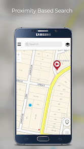
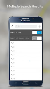
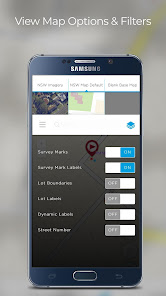
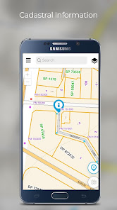
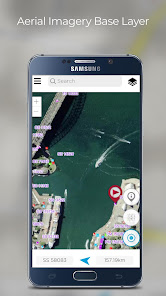
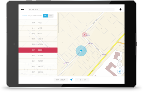
• Search and/or view the location of survey marks against various NSW base maps and imagery
• View and download the locality sketch plan of a survey mark
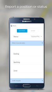
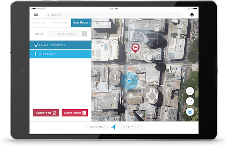
• Report back to DCS Spatial Services regarding the status of the mark, such as found intact, not found, damaged, destroyed etc. including photos for evidence.
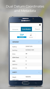
New functionality enables users to view published coordinate values, in either GDA2020 or GDA94 datums, of permanent survey marks, including metadata such as accuracy and status.
Customers can be assured of ongoing app updates to ensure that the app keeps up with new hardware and software technology.
The app is open to the public, however, the target customer base are surveyors and members of the spatial and construction industries.
The App allows users to:
• Search and/or view the location of survey marks against various NSW base maps and imagery
• View and download the locality sketch plan of a survey mark
• Report back to DCS Spatial Services regarding the status of the mark, such as found intact, not found, damaged, destroyed etc. including photos for evidence.
New functionality enables users to view published coordinate values, in either GDA2020 or GDA94 datums, of permanent survey marks, including metadata such as accuracy and status.
Customers can be assured of ongoing app updates to ensure that the app keeps up with new hardware and software technology.
Updated on
Safety starts with understanding how developers collect and share your data. Data privacy and security practices may vary based on your use, region and age The developer provided this information and may update it over time.

No data shared with third parties
Learn more about how developers declare sharing

No data collected
Learn more about how developers declare collection
What's new
We had a few users who were unable to use the app on some latest devices. We have now fixed that and recommend to please update the app to the latest version.
We have fixed the dark mode text issues.
We have fixed the dark mode text issues.