
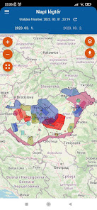
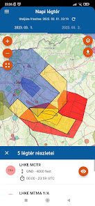
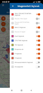
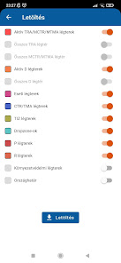
Napi légtér
100+
Downloads

Everyone
info
About this app
Safety starts with understanding how developers collect and share your data. Data privacy and security practices may vary based on your use, region, and age. The developer provided this information and may update it over time.

No data shared with third parties
Learn more about how developers declare sharing

No data collected
Learn more about how developers declare collection
What's new
-TRA51A határai frissítve
-lehet külön szűrni R1-R1A légterekre
-lehet külön szűrni R1-R1A légterekre
App support
About the developer
Kirisics András
kiri.wt@gmail.com
Budapest
Nem nyilvanos
1111
Hungary
undefined