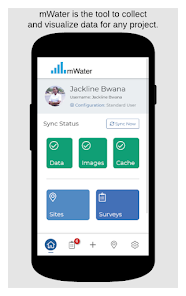
mWater Surveyor

4.5star
732 reviews
100K+
Downloads

Everyone
info


About this app
With mWater Surveyor you can:
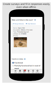
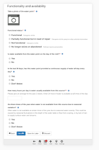
• Record data for any surveys you want
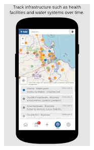
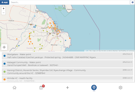
• Map sites and monitor them longitudinally with surveys
• Track data over time for water points, water systems, communities, health care facilities, schools, and other infrastructure
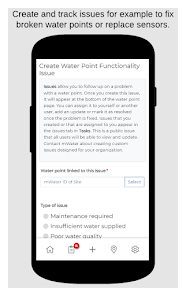
• Assign, receive and complete tasks
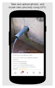
• Upload photos
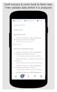
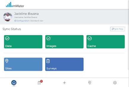
• Work offline and data will sync automatically when reconnected
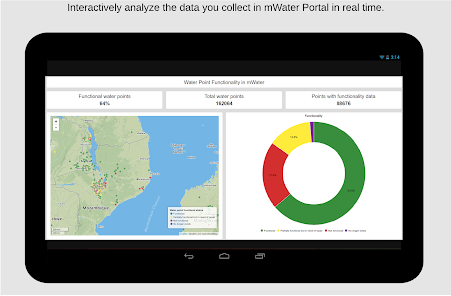
• Analyze results in real time
You can design your own forms, manage, map, and analyze your data at https://portal.mwater.co
Available in 20 languages
mWater is free to user forever
• Record data for any surveys you want
• Map sites and monitor them longitudinally with surveys
• Track data over time for water points, water systems, communities, health care facilities, schools, and other infrastructure
• Assign, receive and complete tasks
• Upload photos
• Work offline and data will sync automatically when reconnected
• Analyze results in real time
You can design your own forms, manage, map, and analyze your data at https://portal.mwater.co
Available in 20 languages
mWater is free to user forever
Updated on
Safety starts with understanding how developers collect and share your data. Data privacy and security practices may vary based on your use, region and age. The developer provided this information and may update it over time.

No data shared with third parties
Learn more about how developers declare sharing

This app may collect these data types
Location and Device or other IDs

Data is encrypted in transit

You can request that data be deleted
Ratings and reviews
4.5
692 reviews

Pessimism Daily
- Flag inappropriate
21 July 2020
As a new user, the Surveyor app's GUI was very simple and straightforward in helping me construct and customize different data surveys. Customer support was also very friendly and responsive in helping me sort out my offline sync issues.
212 people found this review helpful

Yuvraj Sharma
- Flag inappropriate
22 September 2022
It made my research survey easier. I used mWater in my undergraduate research and its really good. The best part is , you don't have to do anything for demographic data if you are doing social science research which saves your time.
68 people found this review helpful

A Google user
- Flag inappropriate
1 February 2020
Does not work well. Every time I open it it says update is available and fails to work whether I accept the update or not. So basically I have uninstall and reinstall every time.
129 people found this review helpful
mWater
4 February 2020
We're very sorry you are having this difficulty. We are looking into it. Could you submit a Problem Report from the app on your device from the Settings tab so we will have more details to help you?
What's new
Fix accounting handling
App support
About the developer
MWATER Foundation Inc.
info@mwater.co
215 S Wadsworth Blvd Ste 400
Lakewood, CO 80226-1566
United States
+1 917-520-0552


